JA/KN-006
Original: Ryota / JJ1WTL — 499052245 · Original Japanese HTML
Published: 2023-04-18
English translation of the archived article text. The author’s first-person observations, uncertainty and later additions are preserved; this is not the research summary. Image contents are preserved as images, not silently incorporated into the translated prose.
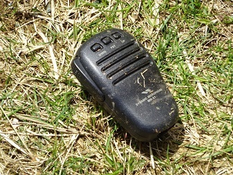
Mount Oyama. I found an MH-31 microphone head and am keeping it safe. If you think it may be yours, please get in touch. It was east of the easternmost station building. It had been left out in the rain and the elements, but after letting it dry naturally I confirmed that it works—as you would expect of Yaesu.
To the trailhead
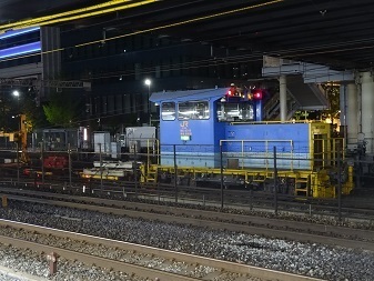
Sunday, April 16. A Shinkansen track-maintenance vehicle, marked ‘MO-8549 — Shinkansen Railway, Facilities Department’.
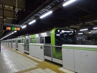
 Tamachi 04:39 → 05:02 Shinjuku 05:27 → 06:24 Isehara 06:35 → by bus → 06:57 Oyama Cable.
The first Shinagawa-bound train originating at Tamachi, arriving empty from the Shinagawa side. There is a crossover south of Tamachi; it was not running the wrong way along the main line.
Tamachi 04:39 → 05:02 Shinjuku 05:27 → 06:24 Isehara 06:35 → by bus → 06:57 Oyama Cable.
The first Shinagawa-bound train originating at Tamachi, arriving empty from the Shinagawa side. There is a crossover south of Tamachi; it was not running the wrong way along the main line.
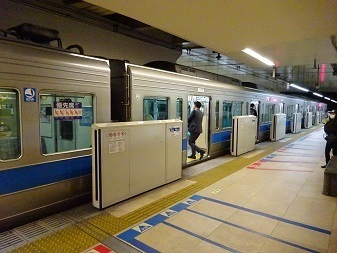
 Changing to Odakyu at Shinjuku.
 By bus from Isehara. I got a seat. The cable car does not start running until 09:00, so these are the people who will walk up from the foot of the mountain before then.
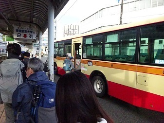 Sunnier than I expected. Started the ascent at 07:13.
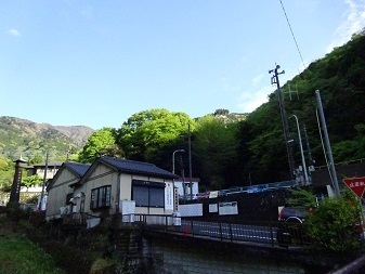
To the summit
Without using the cable car, I went:
- Up via Otokozaka—the men's slope… an endless stone-stairway hell, orz.
- Down via Onnazaka—the women's slope.
Mount Fuji on the way.
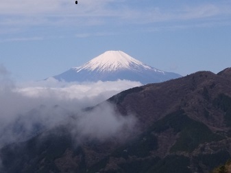 Arrived at 09:55, 1,252 m. My second visit to Oyama (previous visit: https://jj1wtl.seesaa.net/article/202103article_10.html). Everything down below is white.
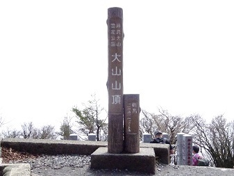 Open for business. The summit is the boundary between three cities: Atsugi, Isehara and Hadano. I will operate from the Atsugi side.
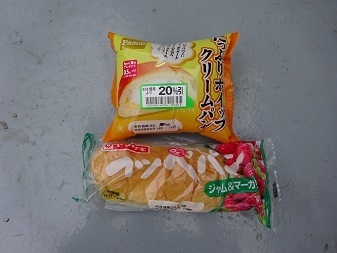
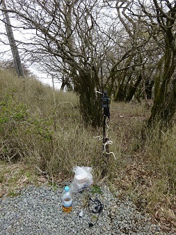 Seventeen stations called me between 10:23 and 10:59; when the calls stopped, I went looking for other stations and worked two more, 11:03–11:06. The longest contact was 110 km, to Chikusei City (430 MHz FM, 1 W). With the weather forecast to deteriorate, I ate and started down early.
Homeward
Still quite sunny considering the forecast. It did rain after I got home, though, at 15:45.
11:37 — Started down.
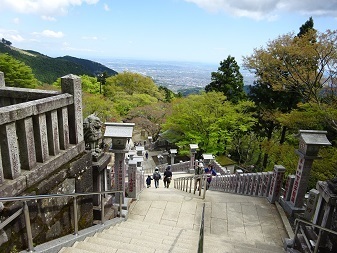
12:51 — Oyama Afuri Shrine, lower shrine ↓
 No photographs after this: I was running to make connections.
13:42 — Bus departed Oyama Cable. 14:03 — Arrived at Isehara Station north exit. 14:08 — Odakyu departed Isehara. 15:08 — JR departed Shinjuku.
Expenses
| Cost | Item |
|---|---|
| ¥208 | JR, Tamachi → Shinjuku |
| ¥607 | Odakyu, Shinjuku → Isehara |
| ¥315 | Bus, Isehara Station north exit → Oyama Cable |
| ¥100 | Mountain admission fee |
| ¥315 | Bus, Oyama Cable → Isehara Station north exit |
| ¥607 | Odakyu, Isehara → Shinjuku |
| ¥208 | JR, Shinjuku → Tamachi |
| ¥2,360 | Total |
¥124.2/QSO, for 19 stations in total.
Looking around the transmitter towers
Oyama summit on Google Maps: https://www.google.com/maps/@35.4413794,139.2309812,44m/data=!3m1!1e3
Kato Denki Kogyosho, ‘FPU (parabolic antenna rotator)’: https://kdk-katoudenki.co.jp/product/product01.html
Overview from the south, looking across the toilets:
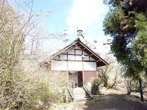
TEPCO
There were more antennas. Are they renting out space in the station building? I have a hunch it is a company called JOSADA TELECOM. SRI if I am completely off the mark. Or perhaps replacement work is under way. Only this image can be enlarged by clicking.

TEPCO's site is in Atsugi City: https://www.tele.soumu.go.jp/musen/SearchServlet?pageID=4&IT=A&DFCD=0000012213ⅅ=1&styleNumber=21
9M50D7W  6755MHz   40mW  → Atsugi office
9M50D7W  6825MHz  500mW  → JERA Yokosuka Thermal Power Station
9M50D7W  6745MHz  500mW  → Shin-Fuji Substation, Oyama Town
9M00D7W  6815MHz  200mW  → Maruyama radio relay station, Yokoze Town
There are two theories about the FPU on the right of the photograph:
- Theory 1: it belongs to NTV/Fuji TV, connected underground to the station building in the next section. http://home.p04.itscom.net/yama/FM_Yokohama/FM_Yokohama.htm
- Theory 2: it belongs to TBS, by elimination. http://mitearuki.sakura.ne.jp/tower/14-kanagawa/ooyama-fmy.html
Shared by NTV and Fuji TV
East of TEPCO. From the south:
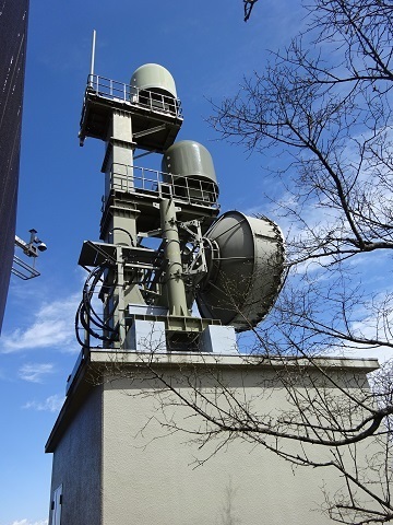
From the north… this was when I found the microphone mentioned at the start.
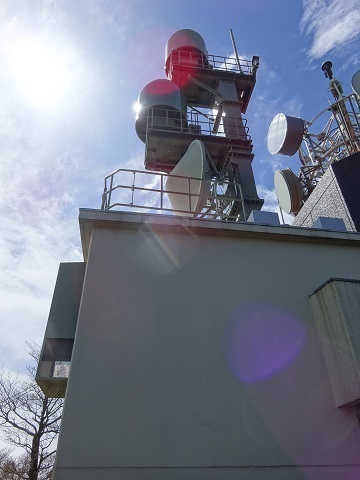
One dish points toward Shiodome and the other toward Odaiba.
NTV, Atsugi City: https://www.tele.soumu.go.jp/musen/SearchServlet?pageID=4&IT=A&DFCD=0000015327ⅅ=1&styleNumber=21
Fuji TV, also Atsugi City: https://www.tele.soumu.go.jp/musen/SearchServlet?pageID=4&IT=A&DFCD=0000015328ⅅ=1&styleNumber=21
TBS
There is a paper about it: ‘10-11 Oyama FPU Receiving Base: Aiming for the Coexistence of Nature Conservation and Radio Facilities’ https://www.jstage.jst.go.jp/article/ncrtv/22/0/22_261/_article/-char/ja/
If it is still arranged as described above, TBS's FPU and its dish toward Akasaka are hidden in the roof space of this building below.
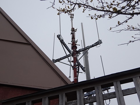
This building on Google Maps: https://www.google.com/maps/@35.4408579,139.2312499,41m/data=!3m1!1e3
TBS's location is listed as Isehara City, so that fits: https://www.tele.soumu.go.jp/musen/SearchServlet?pageID=4&IT=A&DFCD=0000015290ⅅ=1&styleNumber=21
TV Asahi
Toward Roppongi.
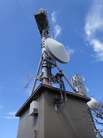
This station is in Hadano City: https://www.tele.soumu.go.jp/musen/SearchServlet?pageID=4&IT=A&DFCD=0001467664ⅅ=1&styleNumber=21
FM Yokohama
Toward Landmark Tower.
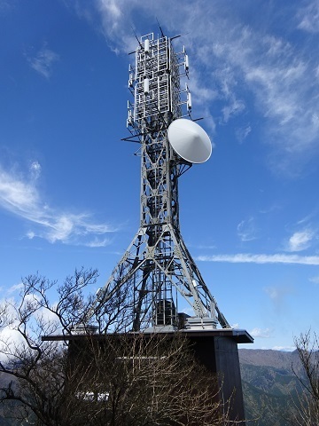
This is the only one whose owner can be identified from a sign.
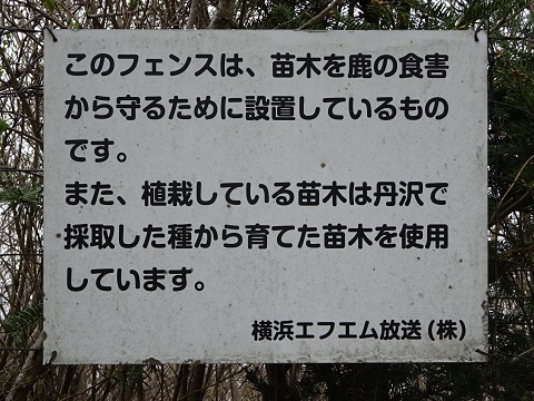
This station is also in Hadano City: https://www.tele.soumu.go.jp/musen/SearchServlet?pageID=4&IT=A&DFCD=0003616790ⅅ=1&styleNumber=21
There seems to have been an opposition campaign: Kanagawa Nature Conservation Association, an incorporated nonprofit organization: ‘On the Relocation and Construction of FM Yokohama's Main Transmitting Station: Must It Really Be on the Summit of Oyama?’ http://www.eco-kana.org/doc/ooyama-iten.doc
It is a .doc file, so some browsers may block the download.
JOSADA TELECOM's licences follow
Eleven stations in all. Transmission appears to use two parallel channels on every section. My reading is that the ‘Atsugi’ station among these piggybacks on TEPCO's Oyama facility. Sorry to repeat myself, but VY SRI if I have this wrong. Still adding to this section.
Minamiboso City ①
https://www.tele.soumu.go.jp/musen/SearchServlet?pageID=4&IT=A&DFCD=0003928886ⅅ=1&styleNumber=21
53M5D7W  6015MHz  50mW  → Minamiboso ②
53M5D7W  6135MHz  50mW  → Minamiboso ②
SoftBank Maruyama International Relay Station: https://www.google.com/maps/@35.0057699,139.9753928,45m/data=!3m1!1e3
Minamiboso City ②
https://www.tele.soumu.go.jp/musen/SearchServlet?pageID=4&IT=A&DFCD=0003928887ⅅ=1&styleNumber=21
53M5D7W  6275MHz  50mW  → Minamiboso ①
53M5D7W  6395MHz  50mW  → Minamiboso ①
53M5D7W  6275MHz  50mW  → Kimitsu
53M5D7W  6395MHz  50mW  → Kimitsu
Hiratsuka: https://www.google.com/maps/@35.1114477,139.9555292,45m/data=!3m1!1e3
or https://www.google.com/maps/@35.1102564,139.9484504,45m/data=!3m1!1e3
or Miyashita: https://www.google.com/maps/@35.0819588,139.9448523,45m/data=!3m1!1e3
Kimitsu City
https://www.tele.soumu.go.jp/musen/SearchServlet?pageID=4&IT=A&DFCD=0003928888ⅅ=1&styleNumber=21
53M5D7W  6015MHz   50mW  → Minamiboso ②
53M5D7W  6135MHz   50mW  → Minamiboso ②
53M5D7W  6015MHz  320mW  → Koto ①
53M5D7W  6135MHz  320mW  → Koto ①
Mount Kanozan: https://www.google.com/maps/@35.2531586,139.9635836,44m/data=!3m1!1e3
Koto Ward ①
https://www.tele.soumu.go.jp/musen/SearchServlet?pageID=4&IT=A&DFCD=0003928889ⅅ=1&styleNumber=21
53M5D7W  6275MHz  320mW  → Kimitsu
53M5D7W  6395MHz  320mW  → Kimitsu
53M5D7W  6275MHz  6.3mW  → Koto ②
53M5D7W  6395MHz  6.3mW  → Koto ②
Mercedes-Benz Chuo, Ariake Service Center: https://www.google.com/maps/@35.6381916,139.7997407,44m/data=!3m1!1e3
or INOUE 5 (Marutake Unyu): https://www.google.com/maps/@35.6379055,139.7993371,44m/data=!3m1!1e3
Koto Ward ② — TEPCO Toyosu?
Dish toward Oyama, Atsugi City: https://www.google.com/maps/@35.6478006,139.7901249,44m/data=!3m1!1e3
https://www.tele.soumu.go.jp/musen/SearchServlet?pageID=4&IT=A&DFCD=0004000033ⅅ=1&styleNumber=21
53M5D7W  6015MHz  6.3mW  → Koto ①
53M5D7W  6135MHz  6.3mW  → Koto ①
53M5D7W  6015MHz  320mW  → Atsugi
53M5D7W  6135MHz  320mW  → Atsugi
The data center served is AT TOKYO CC2 in Shin-Toyosu Cube: https://www.google.com/maps/@35.6486993,139.7926951,44m/data=!3m1!1e3
Atsugi City
https://www.tele.soumu.go.jp/musen/SearchServlet?pageID=4&IT=A&DFCD=0004293304ⅅ=1&styleNumber=21
53M5D7W  6275MHz  320mW  → Koto ②
53M5D7W  6395MHz  320mW  → Koto ②
53M5D7W  6275MHz  320mW  → Susono
53M5D7W  6395MHz  320mW  → Susono
Piggybacking on TEPCO Oyama: https://www.google.com/maps/@35.4413369,139.2311319,44m/data=!3m1!1e3
Susono City
https://www.tele.soumu.go.jp/musen/SearchServlet?pageID=4&IT=C&DFCD=0001503261ⅅ=1&styleNumber=21
53M5D7W  6015MHz  320mW  → Atsugi
53M5D7W  6135MHz  320mW  → Atsugi
53M5D7W  6015MHz  320mW  → Shizuoka
53M5D7W  6135MHz  320mW  → Shizuoka
Aoi Ward, Shizuoka City, Shizuoka Prefecture
https://www.tele.soumu.go.jp/musen/SearchServlet?pageID=4&IT=C&DFCD=0001503260ⅅ=1&styleNumber=21
53M5D7W  6275MHz  320mW  → Susono
53M5D7W  6395MHz  320mW  → Susono
53M5D7W  6275MHz  320mW  → Okazaki
53M5D7W  6395MHz  320mW  → Okazaki
Okazaki City
https://www.tele.soumu.go.jp/musen/SearchServlet?pageID=4&IT=C&DFCD=0001503258ⅅ=1&styleNumber=21
53M5D7W  6275MHz  320mW  → Shizuoka
53M5D7W  6395MHz  320mW  → Shizuoka
53M5D7W  6275MHz  100mW  → Shinshiro
53M5D7W  6395MHz  100mW  → Shinshiro
Somewhere around Mount Kuwagai?
Shinshiro City
https://www.tele.soumu.go.jp/musen/SearchServlet?pageID=4&IT=C&DFCD=0001503259ⅅ=1&styleNumber=21
53M5D7W  6015MHz  100mW  → Okazaki
53M5D7W  6135MHz  100mW  → Okazaki
53M5D7W  6015MHz  320mW  → Yokkaichi
53M5D7W  6135MHz  320mW  → Yokkaichi
The obvious guess would be Mount Hongu.
Yokkaichi City
https://www.tele.soumu.go.jp/musen/SearchServlet?pageID=4&IT=C&DFCD=0001503257ⅅ=1&styleNumber=21
53M5D7W  6015MHz  320mW  → Shinshiro
53M5D7W  6135MHz  320mW  → Shinshiro