JA/SO-027
Original: Ryota / JJ1WTL — 500344252 · Original Japanese HTML
Published: 2023-08-12
English translation of the archived article text. The author’s first-person observations, uncertainty and later additions are preserved; this is not the research summary. Image contents are preserved as images, not silently incorporated into the translated prose.
Mount Ashitaka, also known as Mount Echizen. Combining the trip with a search for JOSADA TELECOM’s microwave route west of Oyama. For SOTA, making the required four contacts was harder than ever: 430 and 144 MHz FM. The route search, however, was a success.
Conclusion: JOSADA TELECOM route map
For JOSADA TELECOM, ‘a proven provider of ultra-low-latency private wireless bandwidth and microwave market data’, I have identified the next hop after Oyama. There is no doubt: it is piggybacking on NTT's Ashitaka Radio Relay Station. Click to enlarge, 1.1 MB.

JOSADA TELECOM in Radio Station Information Search: eleven stations in total. https://www.tele.soumu.go.jp/musen/SearchServlet?SC=1&pageID=3&SelectID=5&CONFIRM=0&OW=FX+0&HZ=3&NA=1010401114875&SK=2&DC=100#result
Outward journey
Friday, August 11, a public holiday. Typhoon No. 7 still seems far enough away, so I go ahead. Tamachi 5:26 → Shinagawa 5:30 / 5:49 → Kozu 6:54 / 7:07 → Gotemba 7:57 / 8:30 → bus → Jurigi 9:15. At Tamachi, the timetable has the Yamanote and Keihin-Tohoku departures simultaneous; the Keihin-Tohoku arrives first.
Shinagawa.
Kozu. My first time on the Gotemba Line.
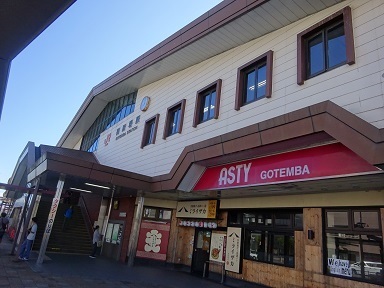
Arrived at Gotemba Station. Outside the Suica area, of course. Station staff are handling adjustments at a temporary desk. For a journey from Tamachi, they say I can use the adjustment machine inside the gates. Adjustment done, then simply touch out.
The Jurigi bus leaves from stop 4.
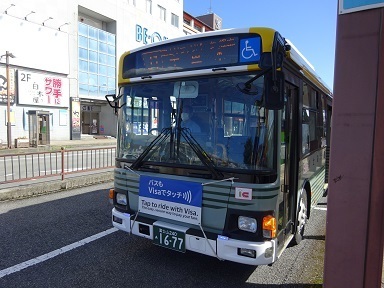
Arrived at the terminus, Jurigi bus stop.
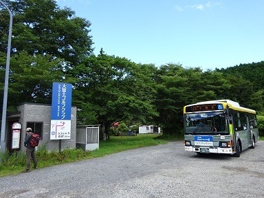
To the summit
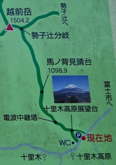
Walking about 500 m west to the trailhead. South is up on this map. Heading for Mount Echizen. Starting at 9:30.
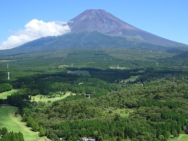
Looking back along the way: JA/SO-001. Later, from Echizen's summit, it is harder to see and disappears into cloud. At the far left is J-Power's Jurigi Relay Station, discussed below.
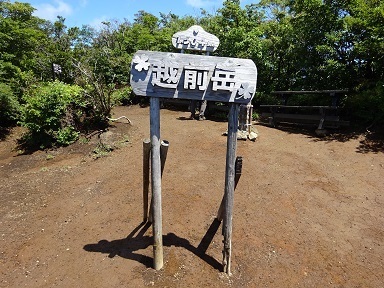
With a detour described below, I arrive at 11:22: 112 minutes instead of the advertised 150-minute ascent.
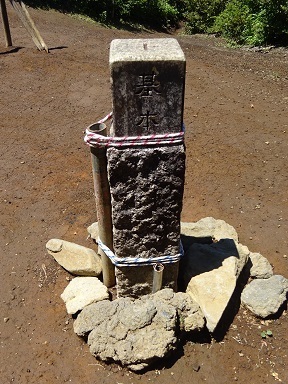
For triangulation-point enthusiasts.
On the air. On the Susono City side; the other choice is Fuji City.
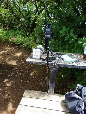
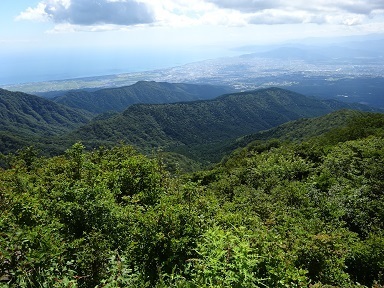
…No callers… Even after increasing to 5 W. While this is happening, the VX-6 gives a HEAT alarm. Just before my descent deadline, I call a faint portable station at Gotemba's New Fifth Station and finally reach four contacts. That was close. I can see so many towns along Suruga Bay, but both 430 and 2 m are deserted. orz.
Descent and journey home
Back down. I raced from a 13:36 start to the trailhead at 14:36: sixty minutes instead of the advertised hundred. The bus leaves at 14:55. Miss it and there is nothing until 18:40.
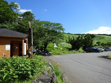
Reached Gotemba Station at 15:43. Jumped aboard with Suica for the 15:45 departure.
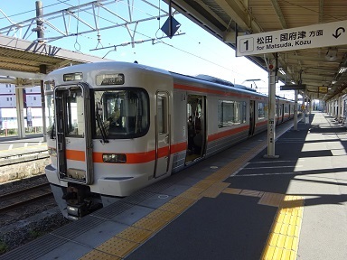
Changing at Kozu onto the 16:56 train for Koganei.
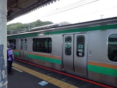
At Tamachi, I adjust the fare at the machine inside the gates. It issues something like a ticket, which I put through the automatic gate to exit. Different from Gotemba, where they told me simply to touch out.
Expenses
¥1,980 — JR, Tamachi → Gotemba. ¥900 — Fujikyu Mobility bus, Gotemba Station → Jurigi. ¥900 — Fujikyu Mobility bus, Jurigi → Gotemba Station. ¥1,980 — JR, Gotemba → Tamachi. ―――――――――――――――――――――――― ¥5,760 total. Four QSOs, so ¥1,440 per QSO.
Touring the transmitting towers
In order from the bottom of the trail, except for J-Power's Jurigi Relay Station. Most of the link directions below are inferred.
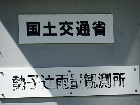
- Ministry of Land, Infrastructure, Transport and Tourism: Sekotsuji Rainfall Observation Station.
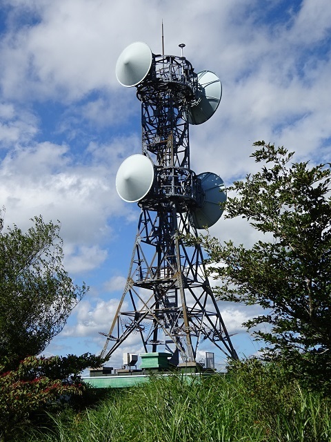
- NTT West: Ashitaka Radio Relay Station.
- (2a) Overall view.
- (2b) JOSADA TELECOM.
- (2c) SoftBank Susono Ashitaka station.
- (2d) Jurigi digital television relay station.
- J-Power: Jurigi passive reflector.
- J-Power: Jurigi Relay Station, viewed from a distance.
- Ministry of Defense: Echizendake Radio Relay Station.
(1) MLIT Sekotsuji Rainfall Observation Station
Marked on Google Maps. https://www.google.com/maps/@35.2530158,138.7856728,135m/data=!3m1!1e3
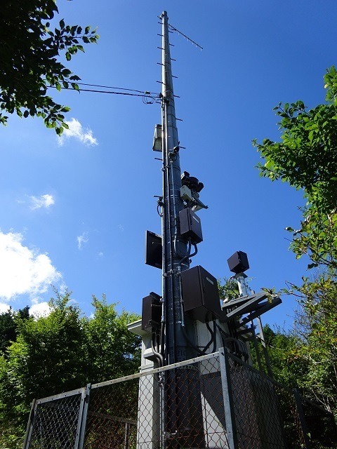
A nameplate is helpful for identifying the facility and its owner.
(2) NTT West Ashitaka Radio Relay Station
It provides a home for various radio stations.
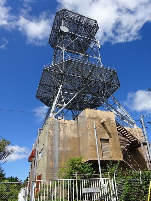
(2a) Overall view
Location: https://www.google.com/maps/@35.2530507,138.7861257,135m/data=!3m1!1e3 In fact, it is already visible from below, at the trailhead. My hunch is that the dishes added here in recent years belong to JOSADA TELECOM.
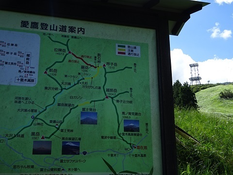
Leaving the trail and circling round to photograph it from the east. What is that suspicious-looking collection of equipment at the foot of the south wall…?
(2b) JOSADA TELECOM
This.
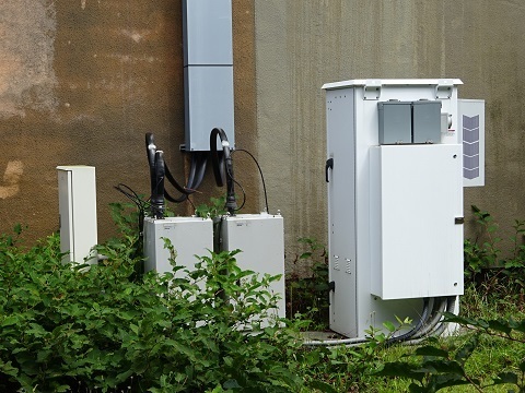
Trying to read the labels… JOSADA TELECOM! Today's first objective achieved.
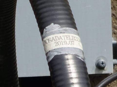
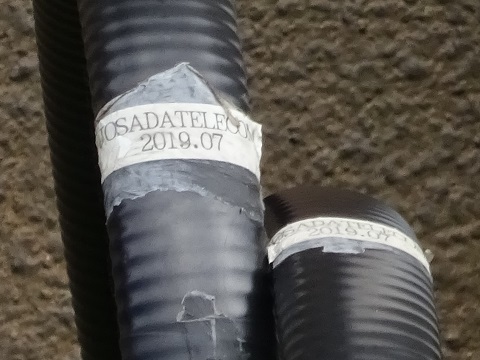
Labels on the equipment too. Made by Fujitsu.
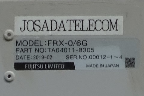
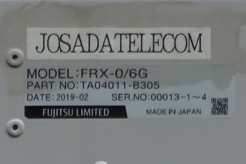
JOSADA TELECOM's power supply arrangement is external. In other words, they are leasing only the structure, without opening up the interior of the station building.
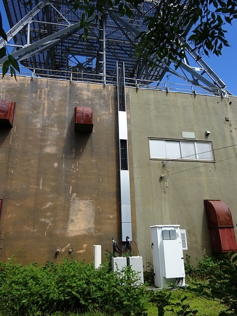
These are the dishes.
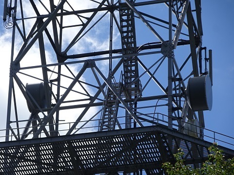
Eastward: towards Oyama, Atsugi City.
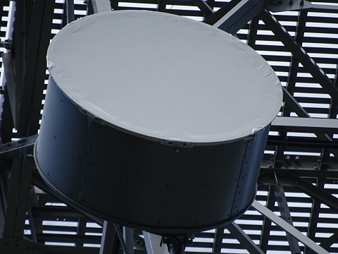
Westward: towards Aoi Ward, Shizuoka City.
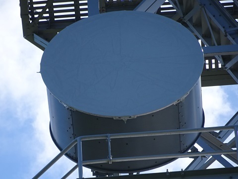
Another dish below JOSADA TELECOM's westward beam.
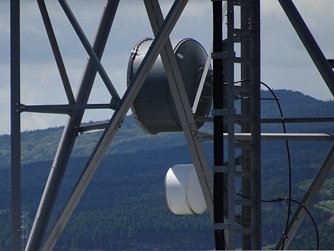
An access link for a mobile-phone base station? Close-up.
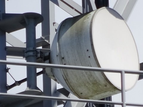
(2c) SoftBank Susono Ashitaka station
On the western wall.
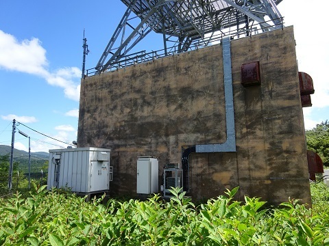
(2d) Jurigi digital television relay station
Along the northern wall. The four-loop antenna at the base receives from Nihondaira.
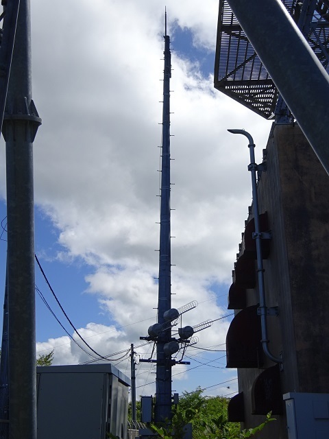
Transmission is from the top of the tower, towards the holiday-home area. Hard to see in the photograph above, so here is another angle.
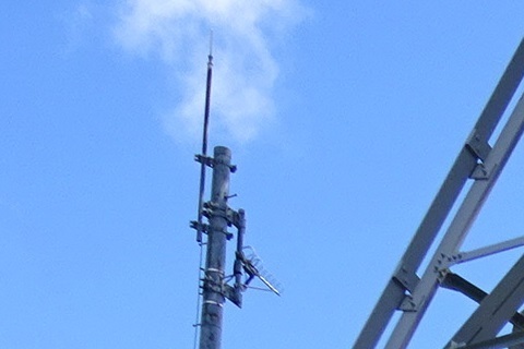
Are these an FPU and a Mount Fuji camera?
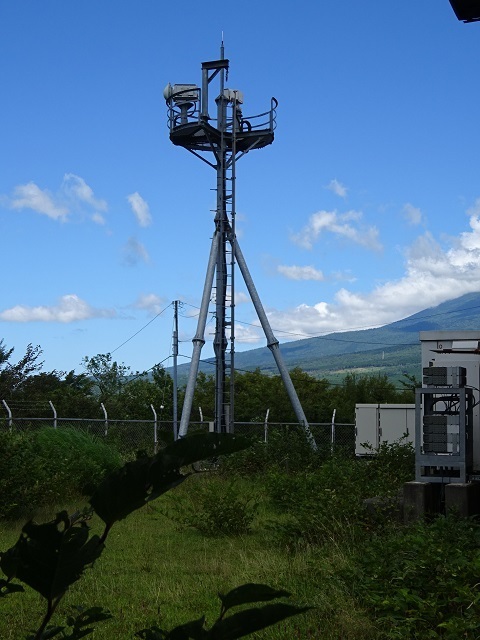
Reference: ‘Jurigi digital television relay station’. http://mitearuki.sakura.ne.jp/tower/22-sizuoka/sizuoka-relay-st/jyurigi-dtv.html
(3) J-Power Jurigi passive reflector
The next group of targets comes into view.
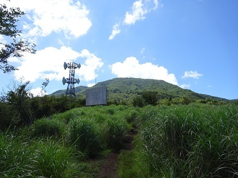
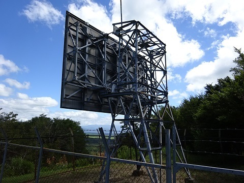
First, the reflector's location: https://www.google.com/maps/@35.2507269,138.7891314,134m/data=!3m1!1e3 It faces north, towards Mount Fuji. A reflector facing the mountain may seem hard to believe, but it links:
- J-Power's Jurigi Relay Station.
- TEPCO's Shin-Fuji Substation in Oyama Town.
The front.
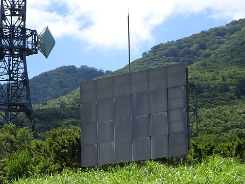
The back. Vegetation has been cleared towards Shin-Fuji Substation.
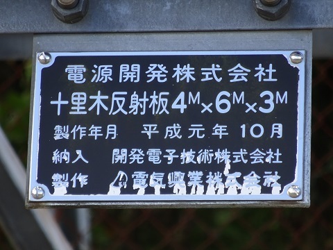
The nameplate on the legs.
(4) J-Power Jurigi Relay Station
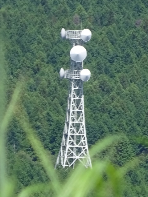
Only a distant view. It is not beside the trail, but northward, at the western end of Jurigi Country Club. With another hour, I could have gone there. Location: https://www.google.com/maps/@35.2639106,138.7754772,139m/data=!3m1!1e3 Photographed from in front of the reflector. The middle dish points precisely this way. The others use space diversity:
- Left/west: towards Mount Oyama in Shizuoka Prefecture.
- Right/east: towards Mount Futago.
They form part of the company's network running the length of Japan.
Route map: https://jj1wtl.seesaa.net/article/202105article_18.html
(5) Ministry of Defense Echizendake Radio Relay Station
Location: https://www.google.com/maps/@35.2505121,138.7894525,135m/data=!3m1!1e3 If you encounter a radio station with a double fence, assuming it belongs to the Ministry of Defense is right nine times out of ten. The building is green for camouflage—just kidding.
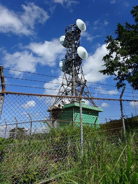
Space diversity, with the following likely counterparts:
- Westward: right in the photograph above, left in the one below. Hamaishidake Radio Relay Station.
https://www.google.com/maps/@35.1171094,138.5321508,199m/data=!3m1!1e3
- Eastward: left above, right below. Hadano Radio Relay Station, at Point 636, south of Mount Sengen on the southern slopes of Oyama in Kanagawa.
https://www.google.com/maps/@35.4185584,139.2386995,132m/data=!3m1!1e3 From farther uphill, photographed on the return.
Comments
Translated from the comments in the archived original HTML. Author names and timestamps are retained as displayed; these are separate from the article.
JQ2GYU 櫻井 — 2023-08-15 17:29
There used to be an NTT microwave relay station at the Ashitaka tower, but I heard that it is no longer used. In fact, optical fibre runs through the Jurigi Kogen holiday-home area on Mount Fuji's southern slopes towards that microwave relay station, passing along a pole in my holiday home's garden. An NTT employee told me that when they moved the pole a few metres. You seem to have been quite nearby, opposite Ashitaka; are my two towers in your photograph towards Mount Fuji? If you had let me know, you could have stayed over. Ha ha.
JJ1WTL — 2023-08-15 20:32
It looks as though they really were in the frame.