JA/KN-006
Original: Ryota / JJ1WTL — 502711233 · Original Japanese HTML
Published: 2024-03-20
English translation of the archived article text. The author’s first-person observations, uncertainty and later additions are preserved; this is not the research summary. Image contents are preserved as images, not silently incorporated into the translated prose.
Mount Oyama. Sunday, March 17. Twenty-nine QSOs; the longest distance was about 92 km to Ora Town. 430 MHz FM, 1 W. — JJ1WTL, candidate in the member-representative election, Kanto. http://motobayashi.net/senkyo/
Outward journey
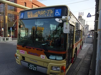
Tamachi 4:39 → Shinjuku 5:02 / 5:27 → Isehara 6:24 / 6:35 → bus → Oyama Cable 7:00. Shinkansen maintenance vehicles. Three sets withdraw towards Shinagawa one after another. Photographed 4:33–4:36.
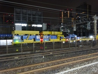
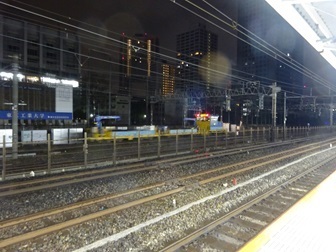
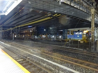
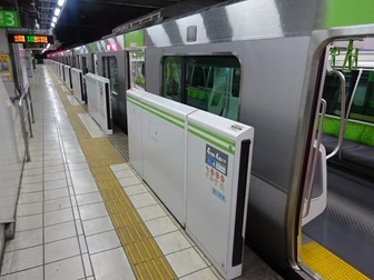
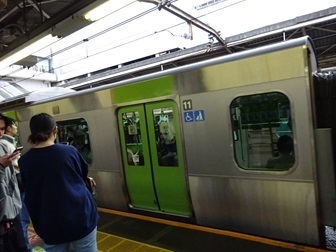
The first clockwise Yamanote Line train.
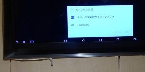
Changing at Shinjuku. The signage in the Odakyu toilets. What operating system is that?
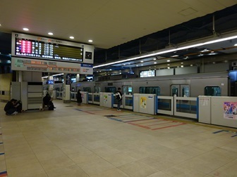
An express for Shin-Matsuda.
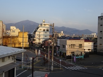
Arrived at Isehara. A distant view. Clear skies.
Fewer than ten people waiting for the bus. Easily got a seat.
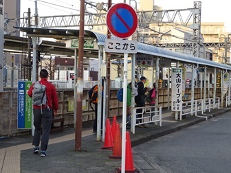
To Oyama.
The climb
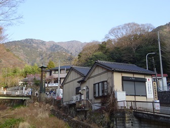
Setting off at 7:11. The cable car is not running yet, so walking up.
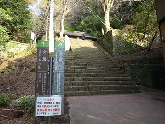
Choosing Otokozaka: thirty minutes of endless stone-stair hell.
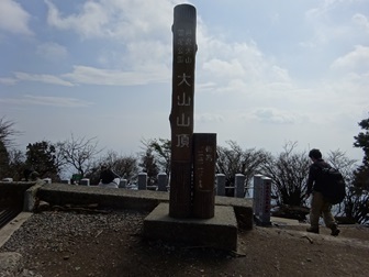
The summit marker. Haze obscures the world below. Arrived at 9:24.
On the air
After wandering around, opening for business.
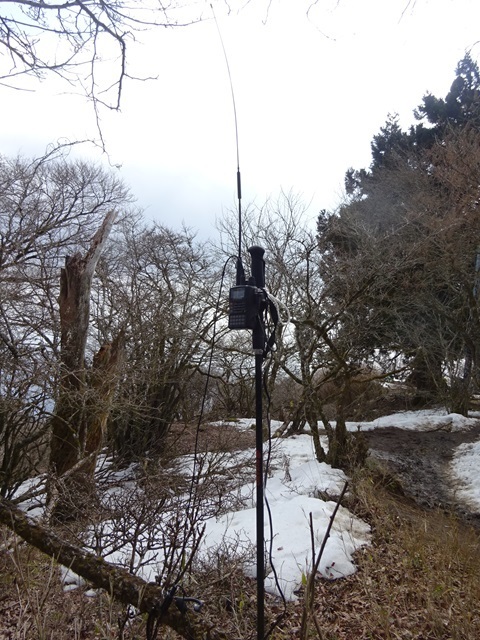
A choice of Isehara, Hadano or Atsugi; I choose Atsugi. Because:
- Hadano has higher places.
- Isehara is where the usual portable Oyama stations all operate.
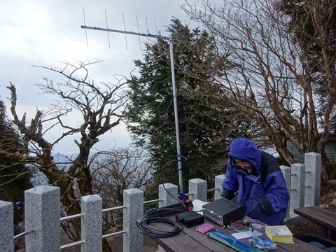
Packed up when the calls stopped; operating time 10:06–10:54. During that time:
- Ex-JF1BNU came to say hello.
- Someone asked, ‘Are you on 430?’
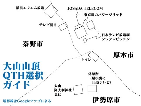
Then I met JA1SHF setting up. Unlike a weakling like me, he had carried up an IC-910. The area with these operating desks lies in Isehara City.
Descent
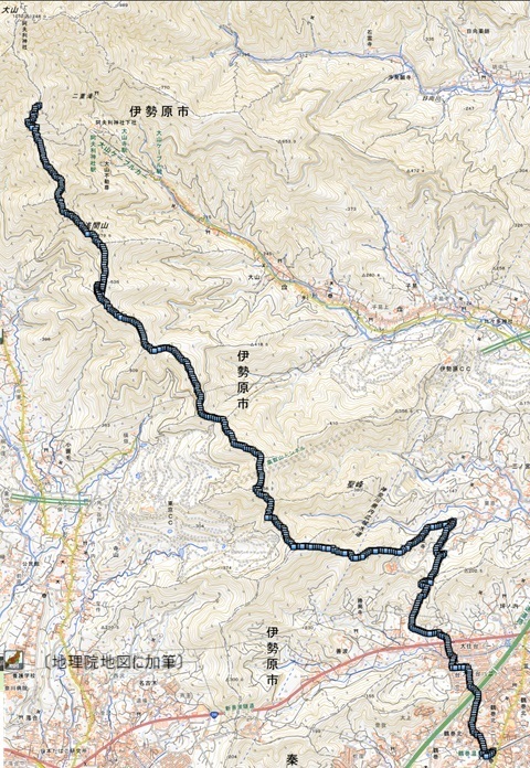
Choosing a different route from usual, towards Minoge-goe. In the end, I walked all the way to Tsurumaki-Onsen Station. The recorded track starts at 11:56, after lunch at the 16-chome junction, and covers 10.5 km. From the summit, it would be just under 12 km. Apparently a leech-infested route, but I made it through unharmed.
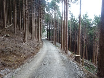
A forest road near Mount Sengen.
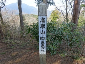
Mount Takatori, 13:35. I walked from Oyama in the background… Here I decide to take the shortest route to Tsurumaki-Onsen Station.
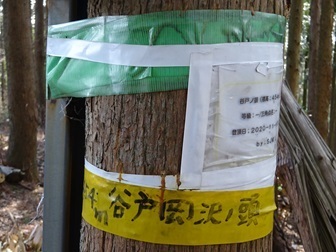
Point 454 m is Yatookazawa-no-Atama; YAMAP calls it Yato-no-Atama. 14:05.
Point 340 m is Mount Banshoji. 14:23.
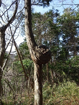
The condition of the trail, shown as a dotted line on the map… It gets even worse farther on… A little regret.
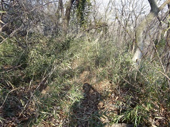
Back alive. I drifted east and did not emerge at the trail exit I had intended. 14:45.
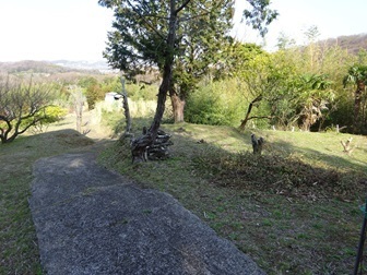
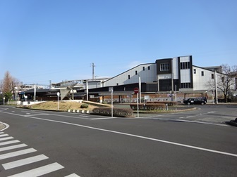
Arrived at Tsurumaki-Onsen Station at 15:30. Onto the 15:43 rapid express.
Changing at Shinjuku, 16:48. Home around 17:30.
Expenses
¥208 — JR, Tamachi → Shinjuku. ¥607 — Odakyu, Shinjuku → Isehara. ¥370 — Kanachu bus, Isehara Station North Exit → Oyama Cable. ¥100 — shrine purification/offerings. ¥607 — Odakyu, Tsurumaki-Onsen → Shinjuku. ¥208 — JR, Shinjuku → Tamachi. ――――――――――――――――――――――― ¥2,100 total. ¥72 per QSO.
Touring the transmitting towers—the ultimate Oyama edition
Some of the owners and counterparts are inferred. Annotations added to GSI Maps.
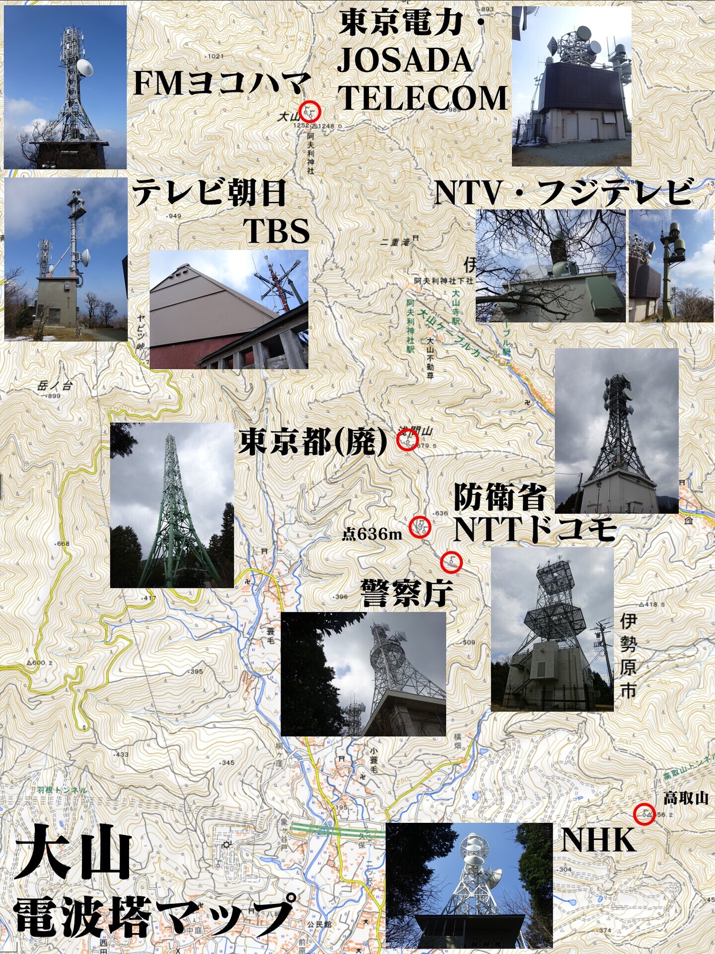
The summit area again:
On Google Maps: https://www.google.com/maps/@35.4413794,139.2309812,44m/data=!3m1!1e3 Proceeding from the north.
FM Yokohama
https://www.google.com/maps/@35.4415116,139.2307687,52m/data=!3m1!1e3 The dish faces Landmark Tower.
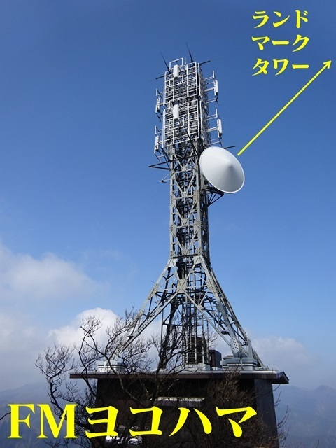
Licence information: Hadano City, fixed stations; likewise below. https://www.tele.soumu.go.jp/musen/SearchServlet?pageID=4&IT=A&DFCD=0003616790ⅅ=1&styleNumber=21
TV Asahi
https://www.google.com/maps/@35.4413904,139.2309566,52m/data=!3m1!1e3 Except for FM Yokohama, the other broadcasters' facilities are not transmitters in the usual broadcast sense. They are mainly FPU receiving stations.
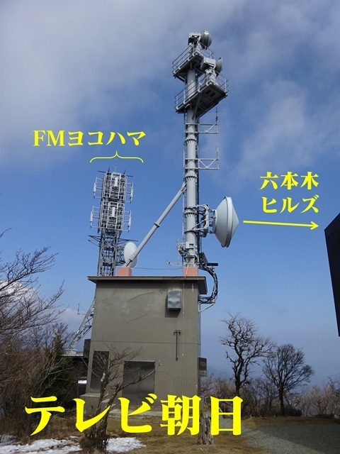
The counterpart is Roppongi Hills. https://www.google.com/maps/@35.6604849,139.7289952,52m/data=!3m1!1e3 Licence information, Hadano City: https://www.tele.soumu.go.jp/musen/SearchServlet?pageID=4&IT=A&DFCD=0001467664ⅅ=1&styleNumber=21
NTV and Fuji Television
https://www.google.com/maps/@35.4414051,139.2312181,52m/data=!3m1!1e3 Shared by the two companies. It is difficult to tell which is which. I tried narrowing it down from the antenna shapes at the other end.
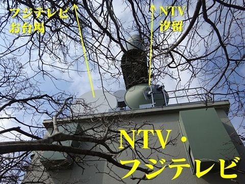
The pointed one is NTV: https://www.google.com/maps/@35.6637134,139.757941,3a,15y,75.21h,141.59t/data=!3m7!1e1!3m5!1sXIdhGvgFSqCadgFDWNBsZw!2e0!6shttps:%2F%2Fstreetviewpixels-pa.googleapis.com%2Fv1%2Fthumbnail%3Fpanoid%3DXIdhGvgFSqCadgFDWNBsZw%26cb_client%3Dmaps_sv.tactile.gps%26w%3D203%26h%3D100%26yaw%3D234.93523%26pitch%3D0%26thumbfov%3D100!7i16384!8i8192?entry=ttu The flat one is Fuji Television: https://www.google.com/maps/@35.626176,139.7727255,3a,15y,56.65h,115.64t/data=!3m7!1e1!3m5!1sRh6w-JEw_KJtLYaqzFuOeA!2e0!6shttps:%2F%2Fstreetviewpixels-pa.googleapis.com%2Fv1%2Fthumbnail%3Fpanoid%3DRh6w-JEw_KJtLYaqzFuOeA%26cb_client%3Dmaps_sv.tactile.gps%26w%3D203%26h%3D100%26yaw%3D103.12174%26pitch%3D0%26thumbfov%3D100!7i16384!8i8192?entry=ttu …Or so I think. South is left and north is right in the photograph. That arrangement keeps the Odaiba and Shiodome beams from crossing, which is neat. There is another tower south of TEPCO's station building. To cover the shadow of that building? And/or to handle two simultaneous relays?
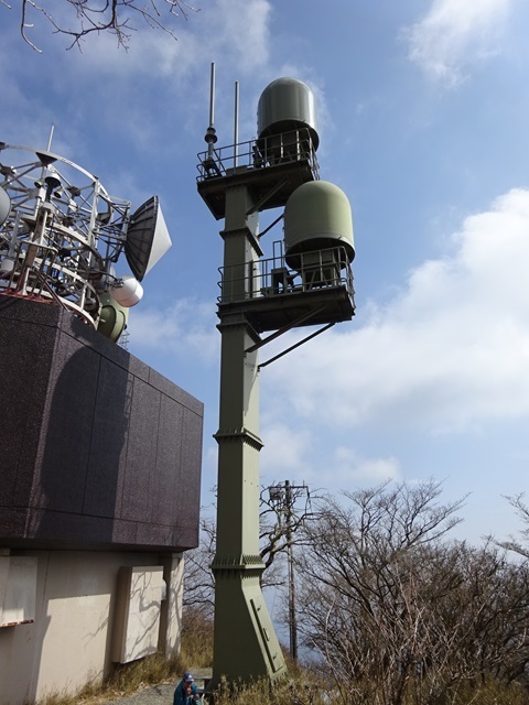
Licence information follows. NTV, Atsugi City: https://www.tele.soumu.go.jp/musen/SearchServlet?pageID=4&IT=A&DFCD=0000015327ⅅ=1&styleNumber=21 Fuji Television, also Atsugi: https://www.tele.soumu.go.jp/musen/SearchServlet?pageID=4&IT=A&DFCD=0000015328ⅅ=1&styleNumber=21
TEPCO
https://www.google.com/maps/@35.4413575,139.2311087,52m/data=!3m1!1e3 JOSADA TELECOM, discussed next, is piggybacking here.
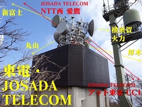
Licence information, Atsugi City: https://www.tele.soumu.go.jp/musen/SearchServlet?pageID=4&IT=A&DFCD=0000012213ⅅ=1&styleNumber=21
My visit to one of its counterparts, Maruyama, JA/ST-012: https://jj1wtl.seesaa.net/article/498573241.html
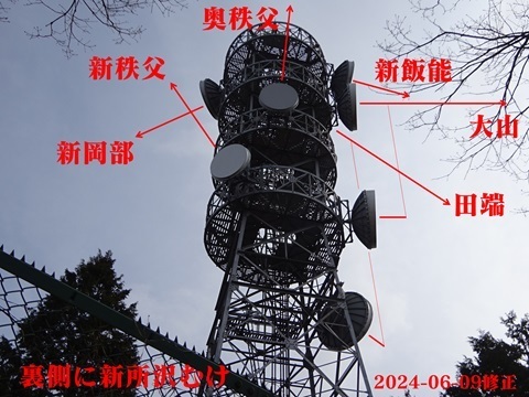
JOSADA TELECOM
Well, well?!
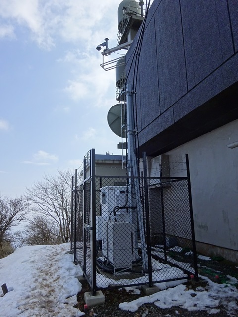
Besides the familiar installation arrangement, piggybacking on the host building, there is a familiar mechanical sound—the fan… This is unmistakably…
Checking my photographs from April 2023, I found it was already there then. At the time, I did not recognize it as JOSADA TELECOM and apparently passed it by.
The enclosures. The large box cut off at the left of the photograph is probably the power supply. The three black pipes probably each lead to one of the three long-bodied rooftop antennas.
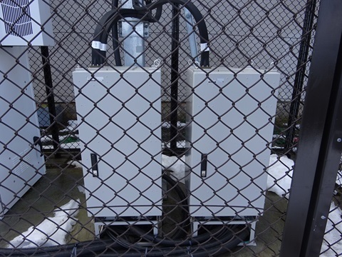
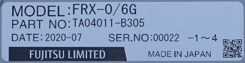
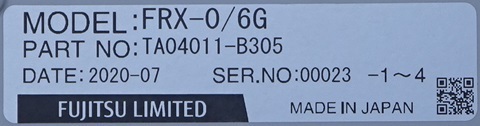
Checking the nameplates! Left, then right:
The next station westward, NTT West Ashitaka Radio Relay Station: https://jj1wtl.seesaa.net/article/500344252.html (English translation) Its station serial numbers were as follows. These appear to be older:
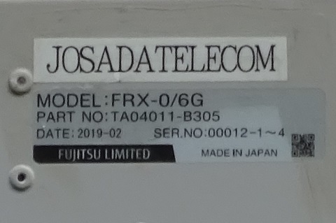
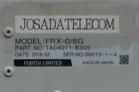
The counterparts are: East: AT TOKYO Central Center, CC1, in Toyosu. https://www.google.com/maps/@35.6478068,139.7901347,52m/data=!3m1!1e3 West: NTT West Ashitaka Radio Relay Station, at Mount Echizen. https://www.google.com/maps/@35.2529485,138.7861959,52m/data=!3m1!1e3! Licence information, Atsugi City: https://www.tele.soumu.go.jp/musen/SearchServlet?pageID=4&IT=A&DFCD=0004293304ⅅ=1&styleNumber=21
TBS
https://www.google.com/maps/@35.4408768,139.2312393,52m/data=!3m1!1e3 Camouflaged on the second floor of this building.
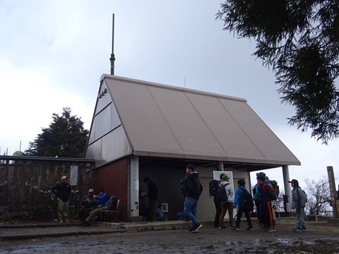
There is a paper about it: ‘10-11 Oyama FPU receiving base: towards coexistence between nature conservation and radio equipment’. https://www.jstage.jst.go.jp/article/ncrtv/22/0/22_261/_article/-char/ja/ There are plausible-looking V/UHF antennas, but I do not know whether they belong to TBS.
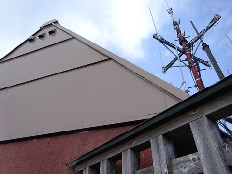
The counterpart is TBS. https://www.google.com/maps/@35.6719468,139.734648,52m/data=!3m1!1e3 Licence information, Isehara City: https://www.tele.soumu.go.jp/musen/SearchServlet?pageID=4&IT=A&DFCD=0000015290ⅅ=1&styleNumber=21 From here, we leave the summit area.
Ministry of Defense
https://www.google.com/maps/@35.4184723,139.238643,52m/data=!3m1!1e3 On the boundary between Minoge in Hadano and Oyama in Isehara, on the peak southeast of Point 636 m. The NTT facility discussed next is immediately south. Left: Ministry of Defense Hadano Radio Relay Station. Right: NTT Docomo Hadano Radio Relay Station.
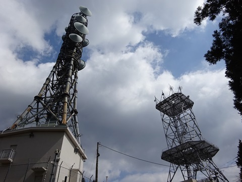
A large site.
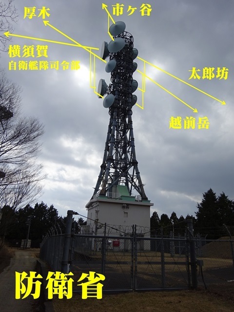
Counterparts, clockwise from the north: Ministry of Defense, Ichigaya. https://www.google.com/maps/@35.6936752,139.7268104,52m/data=!3m1!1e3 Maritime Self-Defense Force Fleet Escort Force headquarters, Yokosuka. https://www.google.com/maps/@35.301556,139.6383404,52m/data=!3m1!1e3 Maritime Self-Defense Force Atsugi Air Base. https://www.google.com/maps/@35.457321,139.4354275,52m/data=!3m1!1e3 Echizendake Radio Relay Station. https://www.google.com/maps/@35.2504548,138.7894225,52m/data=!3m1!1e3 Also called Mount Ashitaka. My visit during the SOTA JA/SO-027 trip: https://jj1wtl.seesaa.net/article/500344252.html (English translation) Tarobo Radio Relay Station. https://www.google.com/maps/@35.3340767,138.8048569,52m/data=!3m1!1e3
NTT
https://www.google.com/maps/@35.4181407,139.2388041,52m/data=!3m1!1e3 The whole facility.
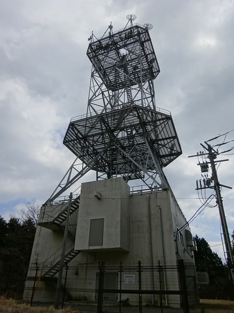
A nameplate.
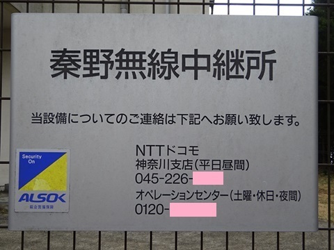
I can see two microwave antennas on the upper platform and one on the lower platform. The radio-path protection-zone map declares three routes from here: Southeast: Terasaka, Oiso Town. https://www.google.com/maps/@35.3195433,139.2891223,52m/data=!3m1!1e3 South: Isshiki, Ninomiya Town. https://www.google.com/maps/@35.3187252,139.2360848,52m/data=!3m1!1e3 Southwest: the roof of New Yoker in Soya/Takasago, Hadano? At least, the route ends here on the protection-zone map. https://www.google.com/maps/@35.3837555,139.2073223,52m/data=!3m1!1e3 It once formed the Ashitaka → Hadano → Shibuya route.
Tokyo Metropolitan Government disaster-management radio
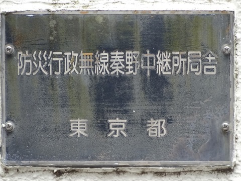
https://www.google.com/maps/@35.4229157,139.2380367,52m/data=!3m1!1e3 Mount Sengen, Minoge, Hadano City. Completely empty. A station established—or formerly established—outside Tokyo's boundaries. Apparently the route was Tokyo Metropolitan Government offices → here → Izu Islands.
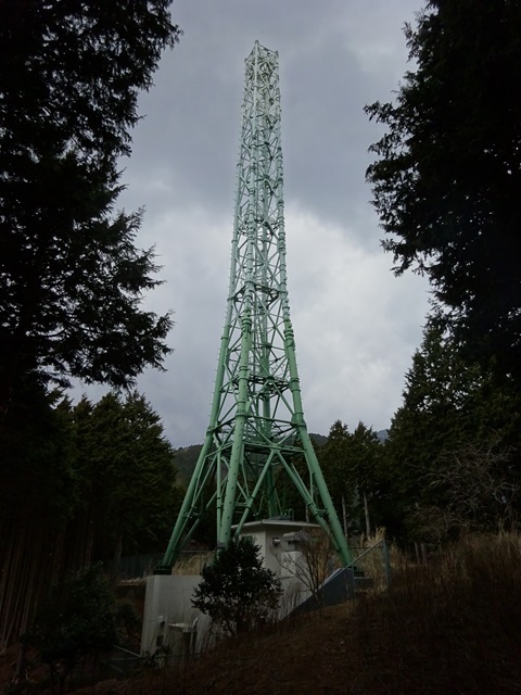
Disaster-management radio, Hadano Relay Station.
National Police Agency
https://www.google.com/maps/place/@35.4164398,139.2409284,52m/data=!3m1!1e3 Koyasu, Isehara City. From the north:
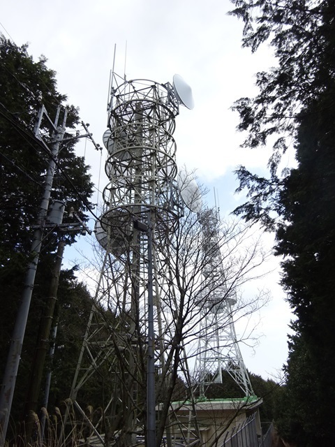
After passing it, from the south:
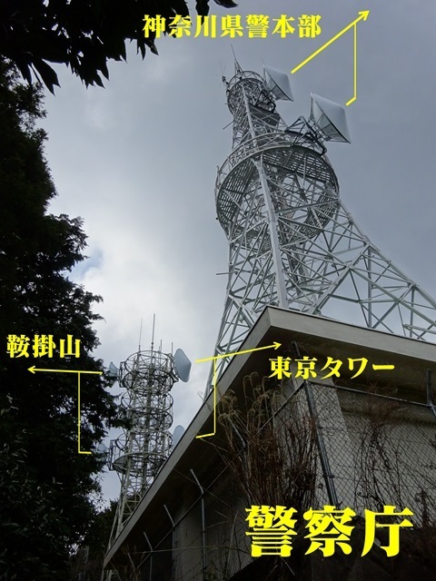
Counterparts, clockwise from the north: Tokyo Tower. https://www.google.com/maps/@35.6588965,139.7454213,52m/data=!3m2!1e3 Kanagawa Prefectural Police headquarters. https://www.google.com/maps/@35.4500993,139.640679,52m/data=!3m2!1e3 Mount Kurakake. https://www.google.com/maps/@35.1748758,139.0268038,52m/data=!3m1!1e3
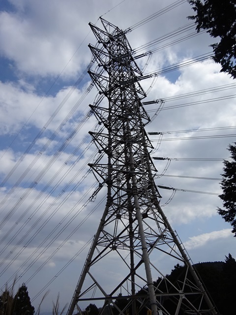
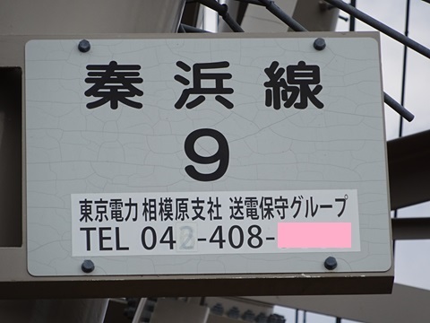
Power-line tower No. 9 on the 秦浜 line—wrong kind of tower!
https://www.google.com/maps/place/@35.4103308,139.2486534,52m/data=!3m1!1e3 Koyasu, Isehara City.
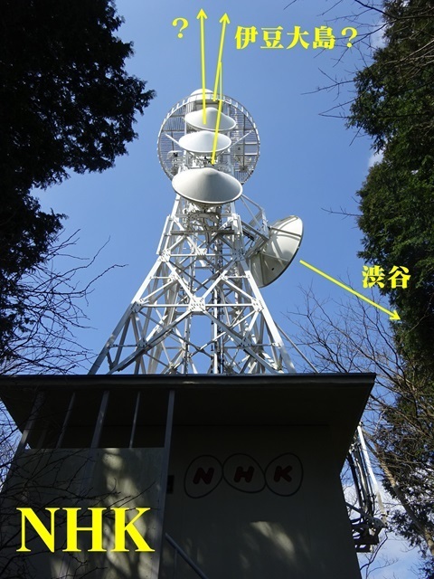
NHK
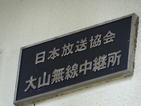
https://www.google.com/maps/@35.4025818,139.2541229,52m/data=!3m1!1e3 Terayama, Hadano City. Japan Broadcasting Corporation, NHK, Oyama Radio Relay Station. Not a broadcast transmitter in the usual sense. The commercial broadcasters are at Oyama's summit; NHK is here.
The nameplate.
The beam that looks like space diversity seems to point to Izu Oshima: https://www.google.com/maps/@34.736843,139.3792283,52m/data=!3m1!1e3 However, some accounts say the Izu Oshima link comes from Shonandaira. Could the beam pointing slightly left/west be paired with the north-facing antenna at Shonandaira? https://www.google.com/maps/@35.3207017,139.3100497,3a,26.8y,87.41h,116.02t/data=!3m8!1e1!3m6!1sAF1QipNfJ5brBq8jQktJZazT1xgquLI1peFfUTZfPTpT!2e10!3e11!6shttps:%2F%2Flh5.googleusercontent.com%2Fp%2FAF1QipNfJ5brBq8jQktJZazT1xgquLI1peFfUTZfPTpT%3Dw203-h100-k-no-pi-0-ya263.71527-ro0-fo100!7i8704!8i4352?entry=ttu