JA/CB-002
Original: Ryota / JJ1WTL — 499180322 · Original Japanese HTML
Published: 2023-04-29
English translation of the archived article text. The author’s first-person observations, uncertainty and later additions are preserved; this is not the research summary. Image contents are preserved as images, not silently incorporated into the translated prose.
Mount Kanozan, 379 m. Absolutely nobody called me. orz. By calling other stations instead, I somehow managed the four contacts required for SOTA. The longest distance was about 88 km, to Ogawa-machi in call area 2, using 430 MHz FM at 2.5 W.
To Mount Kanozan
Saturday, April 29, a public holiday.
Tamachi 7:39 → Tokyo 8:04 → Kisarazu 9:21 / 9:31 → Sanukimachi 9:56 / 10:00 → bus → Kanozan summit stop 10:28.
Tamachi. A crossover has been installed on the Shinagawa side.
On the opposite, Hamamatsucho side, the turnback siding has already been closed. The land will be repurposed for the Haneda Airport rail connection.
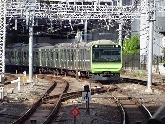
Having missed Shimbashi, I change to the Sobu Rapid Line at Tokyo.
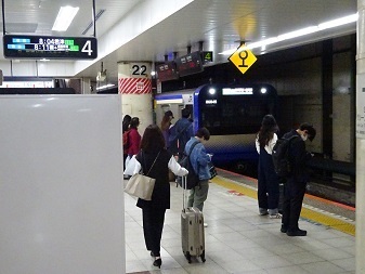
At Kisarazu, onto a two-car train bound for Kazusa-Ichinomiya.
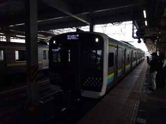
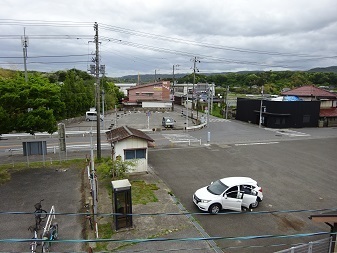
From the footbridge at Sanukimachi Station, photographed on the return journey. The ridge in the centre background is Kanozan.
There is also a Sanuki in Ibaraki.
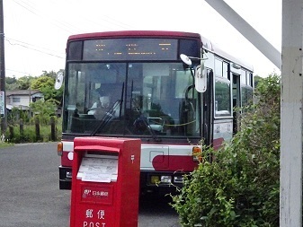
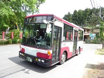
A bus from Sanukimachi takes me almost to the summit. I expected it to be packed, but it was nearly empty.
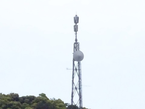
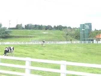
Passing Mother Farm. A radio tower is visible in the back right of the photograph.
Getting off at Kanozan Sancho, one stop before the terminus at Jin'ya-ji, then wandering my way towards the summit.
To the summit
The map. For SOTA purposes, the summit is at Shiratori Shrine, 379 m, rather than the 352.3 m triangulation point.
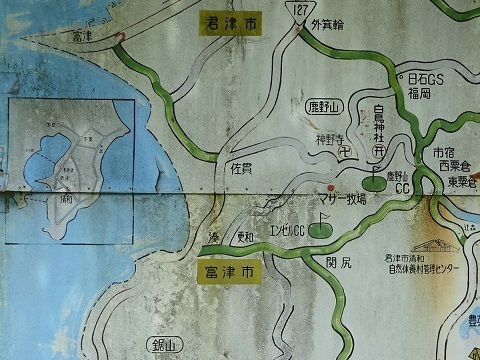
That means the rise at the back of this photograph.
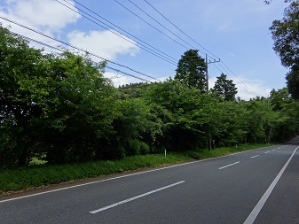
Heading into the woods from Shiratori Shrine. Was barely managing four contacts down to an insufficient offering at the shrine?
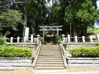
Up in no time. About fifteen minutes from Jin'ya-ji.
https://www.google.com/maps/@35.2555547,139.9719646,44m/data=!3m1!1e3
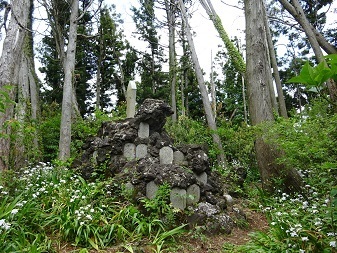
There is no summit-name sign, but there is a stone monument inscribed ‘Yamato Takeru / Kusanagi’.
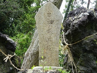
The other stations reported strong winds, but here there was almost no wind.
Heading back
Boarding at the starting stop, Jin'ya-ji, at 12:40. Miss this bus and the wait is nearly two hours. Good thing I made those four contacts.
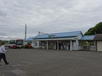
Sanukimachi Station.
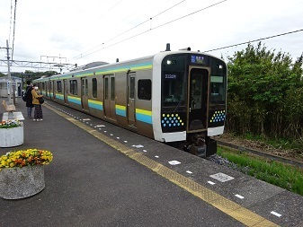
Departing at 13:29.
A cross-platform transfer at Kimitsu. Departing at 14:13.
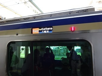
Then a change at Shimbashi. Home before 16:00.
I had been thinking about the briefly active special-event station 8J6DON while away. After its announcement of a switch from SSB to CW, my guess paid off and I was the first to work it, on 7 MHz.
Expenses
¥1,694 — JR, Tamachi → Sanukimachi
¥580 — Nitto Kotsu bus, Sanukimachi Station → Kanozan summit stop
¥580 — Nitto Kotsu bus, Jin'ya-ji → Sanukimachi Station
¥1,694 — JR, Sanukimachi → Tamachi
¥4,548 — total
¥1,137 per contact.
Walking around the transmitting towers
From Sanukimachi Station's footbridge.
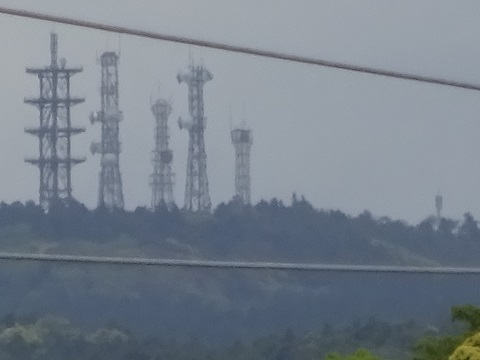
From closer by.
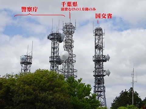
Starting from the west.
Ministry of Land, Infrastructure, Transport and Tourism
https://www.google.com/maps/@35.2544741,139.9585915,44m/data=!3m1!1e3
The facility name.
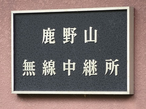
The station building.
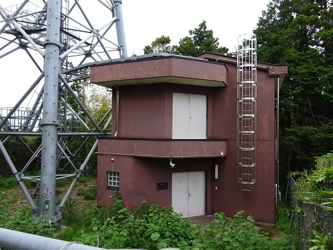
The tower.
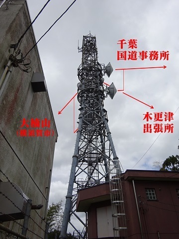
The counterparts are listed below, but the link to the mysterious facility beside the Aqua-Line in Nakajima, Kisarazu, now appears to have been removed.
- Chiba National Highway Office, Inage Ward, Chiba: https://www.google.com/maps/@35.6407375,140.1146151,44m/data=!3m1!1e3
- Mount Ogusu, Yokosuka: https://www.google.com/maps/@35.2497847,139.6252614,44m/data=!3m1!1e3!
- Kisarazu Branch Office: https://www.google.com/maps/@35.3728676,139.9147187,44m/data=!3m1!1e3
- The mysterious facility beside the Aqua-Line in Nakajima, Kisarazu: https://www.google.com/maps/@35.4259531,139.9301115,44m/data=!3m1!1e3
Street View still shows that missing link direction:
National Police Agency
https://www.google.com/maps/@35.254272,139.9586666,44m/data=!3m1!1e3
Double fencing.
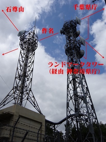
Chiba Prefecture
https://www.google.com/maps/@35.2543333,139.9588664,44m/data=!3m1!1e3
A rather lonely appearance now, with just one link direction. It has become a shared base station for municipal fire and emergency radio services across the prefecture.
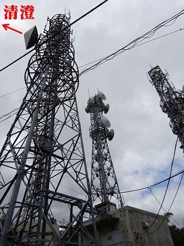
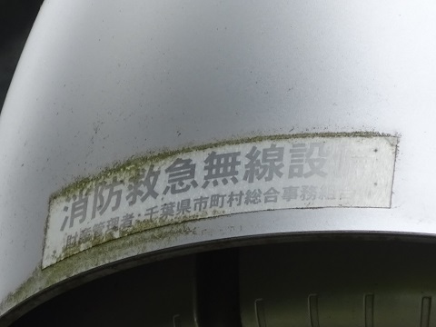
Looking for a clue, I find:
Fire and emergency radio equipment
Property administrator: Chiba Prefecture Municipal General Affairs Association
That is what it says.
The former disaster-management radio network diagram:
https://www.pref.chiba.lg.jp/shoubou/nenpou/documents/12zu1.pdf
listed the following counterparts. However, all appear to have been removed except Kiyosumi: the east-southeast-facing dish, on the route to the Chiba Prefectural Government offices.
- Yanagawa Dam, Kisarazu: https://www.google.com/maps/@35.3475646,139.9863451,44m/data=!3m1!1e3
- Kimitsu Joint Government Building: https://www.google.com/maps/@35.3710642,139.9179783,44m/data=!3m2!1e3
- Katsunan Port / Katsunan Education Office, Funabashi, using space diversity: https://www.google.com/maps/@35.6850949,139.986663,44m/data=!3m1!1e3
- Ichihara Infrastructure Office, Yawata: https://www.google.com/maps/@35.5353673,140.1098912,44m/data=!3m1!1e3
- Kiyosumi relay: https://www.google.com/maps/@35.1634579,140.1552585,44m/data=!3m1!1e3
See also ‘Regulations on the installation and management of fire and emergency radio equipment of the Chiba Prefecture Municipal General Affairs Association’:
https://www1.g-reiki.net/chibasougou/reiki_honbun/x078RG00000045.html
NTT
https://www.google.com/maps/@35.254497,139.9599584,44m/data=!3m1!1e3
Separate from the three facilities above.
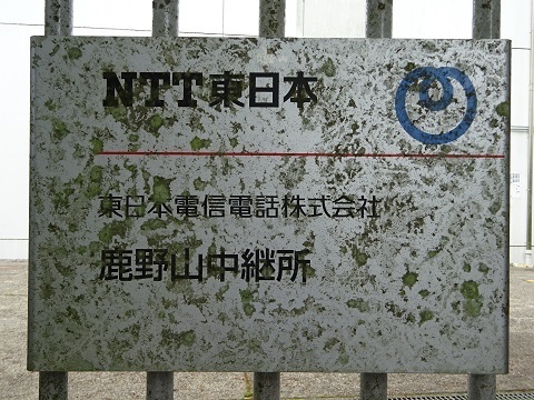
The facility-name sign. So it belongs to NTT East, rather than NTT Communications or Docomo.
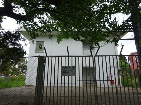
The station building.
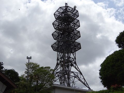
The tower. I looked around carefully, but it carries only two dishes, both facing westward.
A close-up of that part, and the link directions, using the radio-path protection zones as a reference.
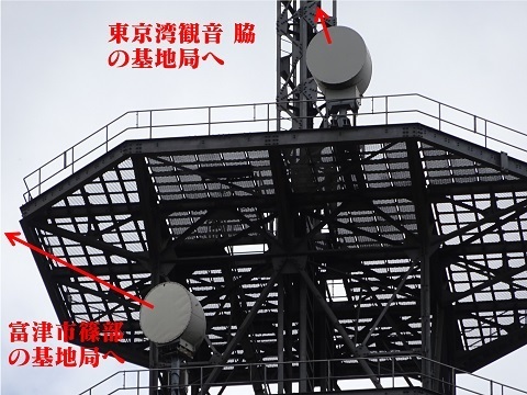
The top platform: almost due west, towards the base station beside Tokyo Bay Kannon. Beyond that station, the route continues to the base station beside the Nozomi-no-Mon Fujimi-no-Sato nursing home in Kazusa-Minato.
https://www.google.com/maps/@35.2640413,139.8638348,44m/data=!3m1!1e3

The second platform from the top: northwest, towards the base station in Shinobe, Futtsu.
https://www.google.com/maps/@35.2983888,139.8508292,44m/data=!3m1!1e3
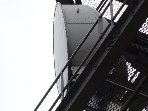
Amateur radio
https://www.google.com/maps/@35.2544181,139.9604982,44m/data=!3m1!1e3
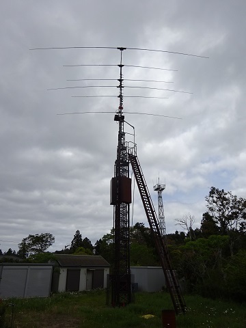
JOSADA TELECOM????????
https://www.google.com/maps/@35.2531445,139.9635712,44m/data=!3m1!1e3
This is what I actually came to see. But there is no identifying name.
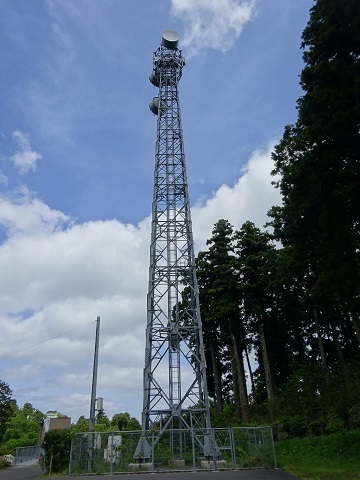
Could this be JOSADA TELECOM equipment connecting SoftBank's Maruyama International Relay Station, a submarine cable landing station, with AT TOKYO's CC2 data centre at Shin-Toyosu Cube? That is my thinking.
It is a service selling low latency through radio waves travelling directly in free space, compared with light travelling through glass along roads:
‘McKay Brothers provides ultra-low-latency microwave bandwidth for data transmission between Tokyo and Singapore’.
https://kyodonewsprwire.jp/release/201611166323
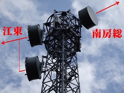
Do they have drum-head covers? The distinctive feature is their depth.
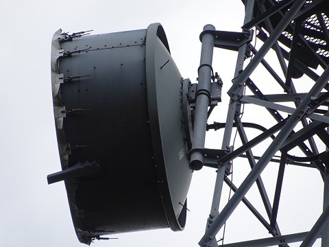
The dishes on the space-diversity side—or should I say the two-dish side?—have a logo on their fronts.
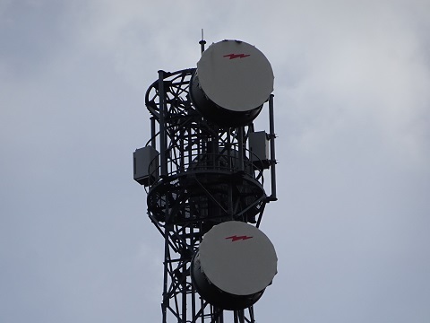
Zoomed in.
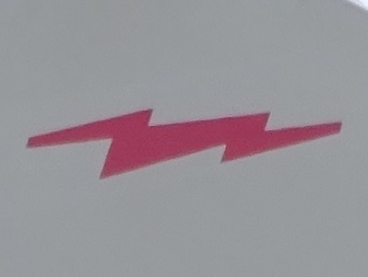
Matching it up identifies an Israeli company called RFcell.
http://www.rfcell.com/mw-antennas
We can establish that it was erected in 2016 or later. That fits the press release mentioned above.
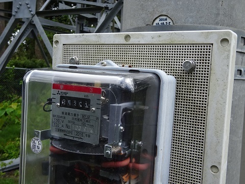
Let's record the layout for reference when identifying the company's other relays.
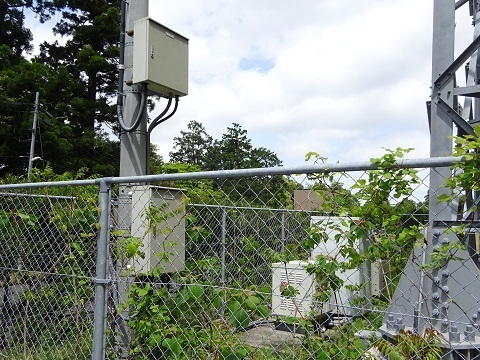
See the end of ‘JA/KN-006’. My interpretation is that after two hops in Koto Ward, the route piggybacks on TEPCO's station building on Mount Oyama.
https://jj1wtl.seesaa.net/article/499052245.html (English translation)
Looking across Mother Farm
From the bus window.
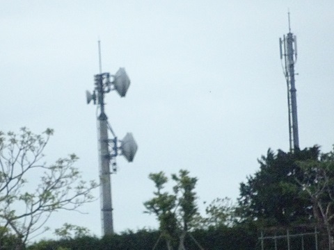
Futtsu television relay station
After descending the mountain, west of Sanukimachi Station. The dish receives from Kimitsu, Mount Asahi.
https://www.google.com/maps/@35.2628086,139.8676744,44m/data=!3m1!1e3
http://mitearuki.sakura.ne.jp/tower/12-chiba/chiba-relay-st/futtu-tv.html