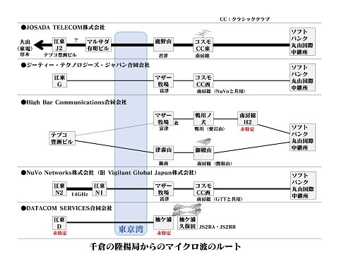
Microwave routes (Mother Farm)
Original: Ryota / JJ1WTL — 500063022 · Original Japanese HTML
Published: 2023-07-19
English translation of the archived article text. The author’s first-person observations, uncertainty and later additions are preserved; this is not the research summary. Image contents are preserved as images, not silently incorporated into the translated prose.
Showing no sign of fatigue from the round trip to KANHAM on local trains, I went out to fill in the missing links. Monday, July 17, a public holiday.
Provisional locations
Before visiting, I identified four locations using Street View.
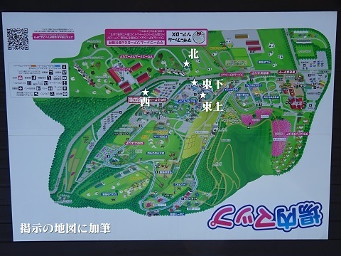
In front of the hilltop gate
Arrived by bus from Kimitsu Station. Here is how the sites look on the ground.
At two o'clock: the north station.
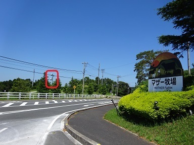
At five o'clock: the upper east station. The lower east station is discussed below.
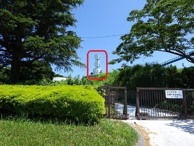
At eight o'clock: the west station.
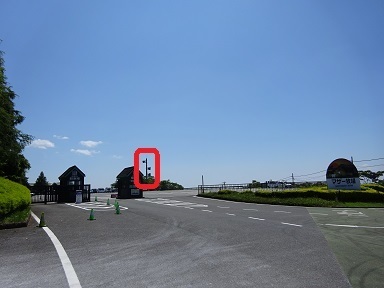
North station
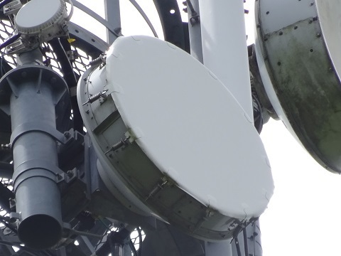
This turned out to be High Bar Communications' Mother Farm station. (Mischievous grin.)
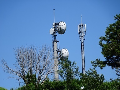
Upper antenna towards central Tokyo.
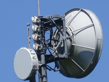
Lower antenna towards central Tokyo.
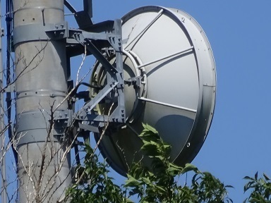
Towards Kamogawa-no-Inu station, around Mount Atago / Cosmo Classic Club:
https://www.google.com/maps/place/@35.1154215,139.9793819,53m/data=!3m1!1e3
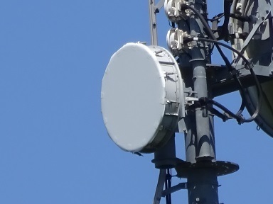
The likely counterpart on the central Tokyo side: TEPCO Toyosu Building (https://jj1wtl.seesaa.net/article/499593521.html (English translation)).
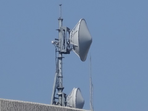
The counterpart, Kamogawa-no-Inu station (https://jj1wtl.seesaa.net/article/499505940.html (English translation)). They look just alike, don't they?
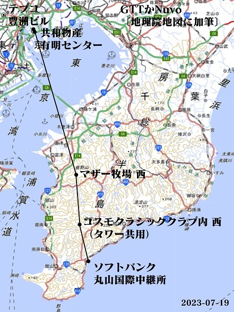
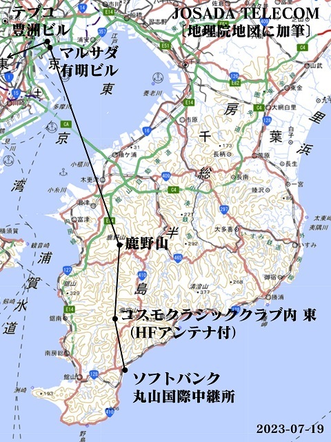
Putting it together gives this.
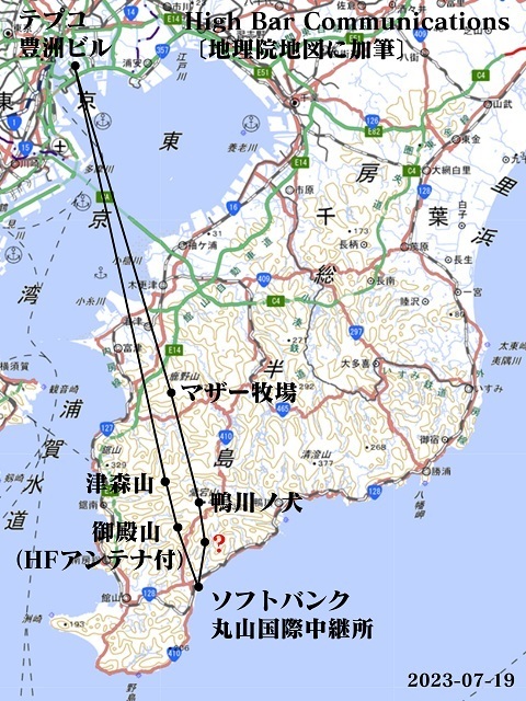
I wonder whether the station marked ?, which I have not yet visited, is around Kuroiwa in Wada-cho, Minamiboso.
https://www.google.com/maps/place/@35.0614347,139.9881844,53m/data=!3m1!1e3
Lower east station
It had turned into a mobile-phone base station. In Street View it still has dishes.
In any case, this resolves the discrepancy between three stations found on the ground and four in Street View.
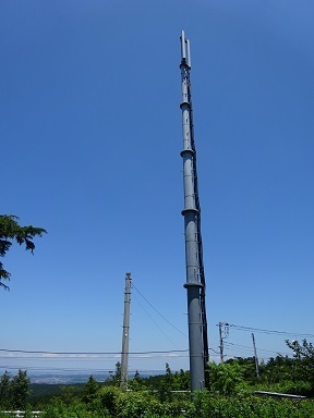
Upper east station
On top of a building. Perhaps that makes it the oldest of the stations.
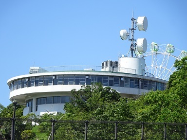
A little closer.
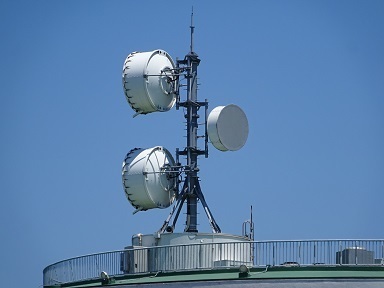
Upper antenna towards central Tokyo.
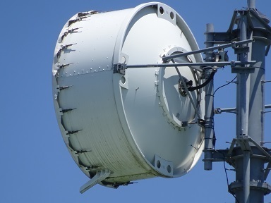
Lower antenna towards central Tokyo.
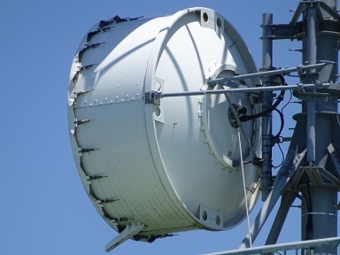
Towards Cosmo Classic Club.
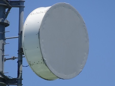
Looking for similarly shaped dishes at the Koto Ward end, I think the counterpart may be No. 5 Inoue Building.
https://jj1wtl.seesaa.net/article/499593521.html (English translation)
https://www.google.com/maps/place/@35.6379219,139.7994117,53m/data=!3m1!1e3
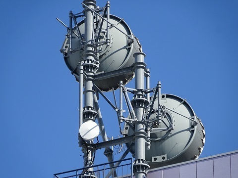
The likely counterpart: the western station inside Cosmo Classic Club. The dish at the lower right looks just like it.
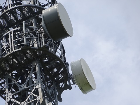
Putting it together. The connection between TEPCO Toyosu Building and No. 5 Inoue Building is still uncertain.
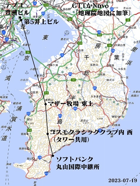
[Added November 3, 2024] The west station in the next section turned out to be NuVo, so by elimination this upper east station is GTT.
West station
Near the car park.
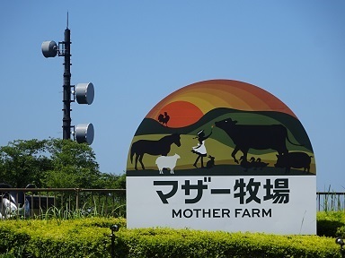
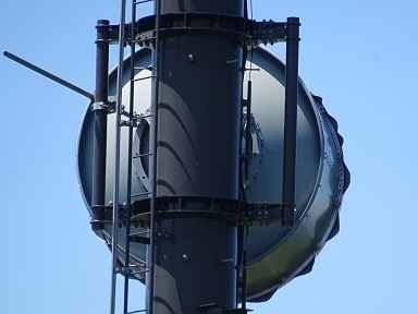
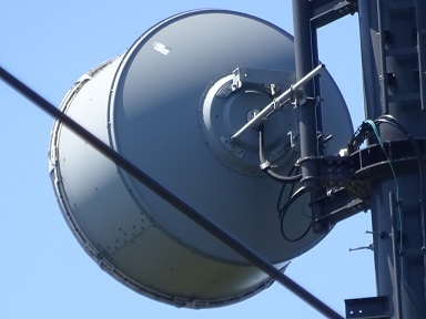
Upper antenna towards central Tokyo.
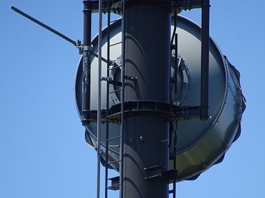
Lower antenna towards central Tokyo.
Towards Cosmo Classic Club.
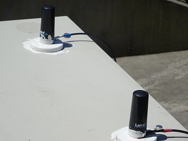
The station building has no identifying name. For a clue in future analysis, here is a photograph of the antenna attached to it. It appears to be a ‘Laird Technologies TRAB806/17103P Phantom Multi Band Cell/GPS Antenna with Cable’.
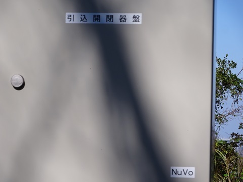
[Added November 3, 2024] The electrical service box identified this as NuVo.
The likely counterpart on the central Tokyo side: Kyowa Bussan Ariake Centre (https://jj1wtl.seesaa.net/article/499593521.html (English translation)).
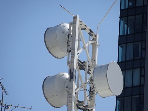
Repeating a photograph shown earlier: the western station inside Cosmo Classic Club, probably the counterpart. The dish at the upper left looks just like it.
Putting it together. The connection between TEPCO Toyosu Building and Kyowa Bussan Ariake Centre is still uncertain.
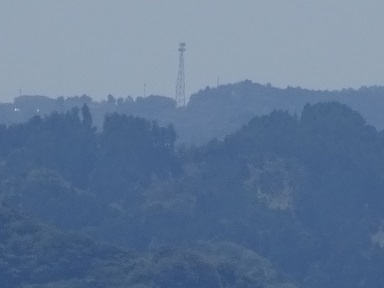
Cosmo Classic Club in the distance
The western station inside Cosmo Classic Club. A tower shared by two companies, with links to two Mother Farm stations. I infer that the companies are GTT and NuVo. The distances are 15.1 km from the west station and 15.2 km from the upper east station.
https://www.google.com/maps/@35.1102488,139.9484372,53m/data=!3m1!1e3
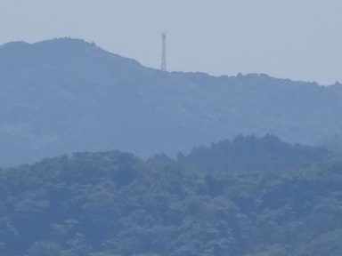
The eastern station, attributed to JOSADA TELECOM. It is 15.7 km from the Kanozan station discussed in the next section.
https://www.google.com/maps/@35.1114643,139.9555314,53m/data=!3m1!1e3
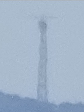
Can you make out the HF antenna mounted on it?
I could not find High Bar Communications' counterpart, Kamogawa-no-Inu station:
https://www.google.com/maps/@35.1153978,139.9792438,107m/data=!3m1!1e3
It should be farther east, 15.3 km away.
Looking towards Mount Kanozan
The JOSADA TELECOM station in the previous section has its counterpart here on Kanozan, rather than at Mother Farm.
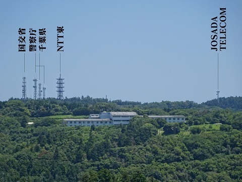
The connection between TEPCO Toyosu Building and Marusada Ariake Building is still uncertain.
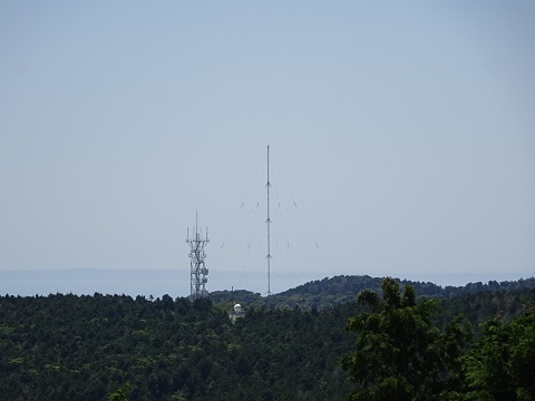
Looking towards the western foot of Mount Kinadayama
Immediately to the west.
An update on Datacom Services in Sodegaura
A microwave licence has been issued, so I revisited the familiar JS2RA / JS2RB site on July 8.
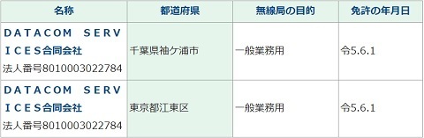
But I could not see any dishes. Another location in the same city? That seems unlikely.
Summary table
Overall, the receiving ends in Koto Ward are still uncertain.