JA/CB-009
Original: Ryota / JJ1WTL — 499916770 · Original Japanese HTML
Published: 2023-07-04
English translation of the archived article text. The author’s first-person observations, uncertainty and later additions are preserved; this is not the research summary. Image contents are preserved as images, not silently incorporated into the translated prose.
Mount Iyogatake, combined with a search for the microwave route: High Bar Communications’ station in Kyonan Town. Sunday, July 2, after the rain. I hurried down for the bus, so only five QSOs. The longest-distance contact was JA1ZCX/1 in Tochigi Prefecture.
Outward journey
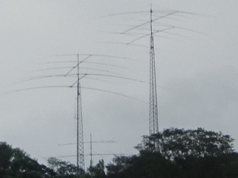
Back to the Boso Peninsula. Heading south on the Uchibo Line, just before Takeoka Station, on the left. Whose home is this?
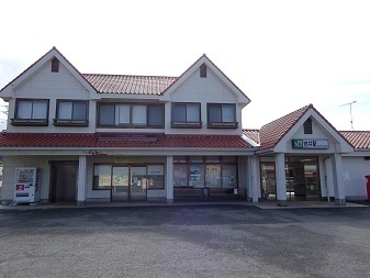
Arrived at Iwai Station at 7:47.
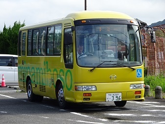
The bus. I had reserved the extended service to Sotono. Departing at 7:55.
Arrived at Sotono at 8:28.
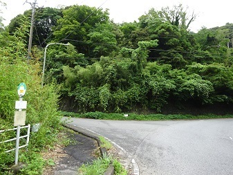
A detour here, described below.
To the summit
Back at the bus stop, 10:29.
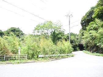
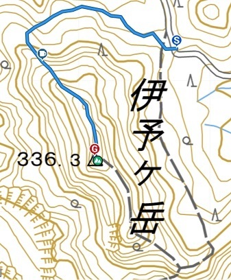
Approaching Iyogatake from the north, behind the normal route. Reached the trail junction at 11:02. Online hiking accounts suggest there may be a direct ascent on a route not shown on the map… Looking for the trailhead. The view straight ahead, southward.
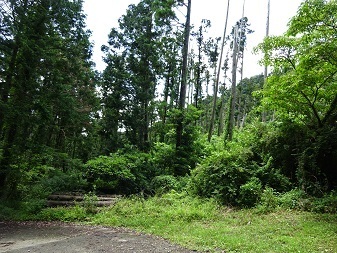
…And to the right, westward.
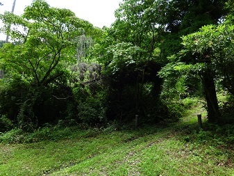
Towards the forest road on the right. There is a trail sign! To the right, westward.
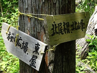
A fairly steep ascent along the way.
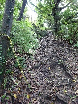
I am taking a back route here, but this is a mountain where fatal falls have occurred: ‘Man from Yachiyo dies after slipping down a steep slope while hiking with his child: Iyogatake, Minamiboso’. https://www.chibanippo.co.jp/news/national/1051506 From my YAMAP track. See, the route is not marked on the map. But it was adequately maintained. About thirty minutes from the trailhead to the summit.
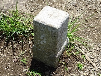
The triangulation point.
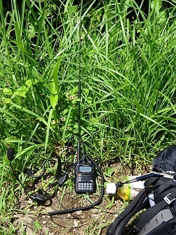
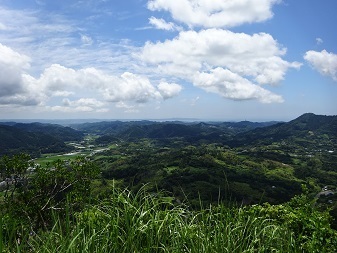
On the air from 11:50 to 11:59. Everyone is in the 6m and Down contest, and I quickly made five contacts—four required—so I hurried down for the 12:49 bus. The next bus is at 14:42. Staying here in the scorching heat for another two hours would be dangerous…
The view.
Descent and journey home
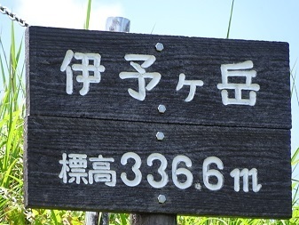
The summit-name marker is on the other peak, the south summit. That should also count under SOTA rules, since the ground between the north and south summits does not drop by 25 m or more.
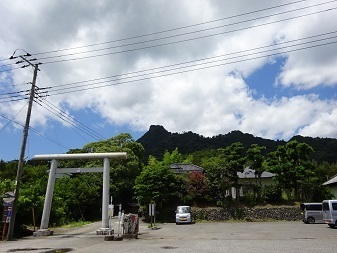
Racing down to the trailhead, reached at 12:40. This is the main entrance.
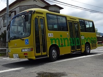
Made the 12:49 bus.
A little over forty minutes' wait at Iwai Station. Departing at 13:59.
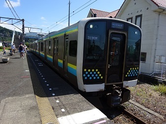
Cross-platform transfer at Kimitsu; departure 14:40.
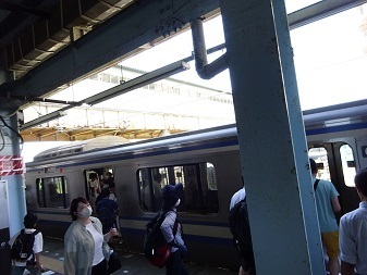
Cross-platform transfer at Tokyo; departure 16:23.
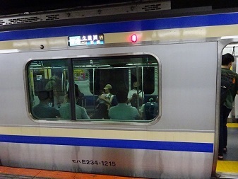
The final change at Shimbashi. Home at 16:46.
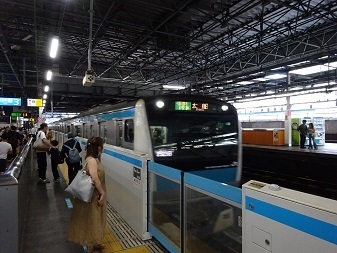
Expenses
¥1,980 — JR, Tamachi → Iwai. ¥200 — Minamiboso municipal bus, Iwai Station → Sotono. ¥200 — Minamiboso municipal bus, Tenjingo → Iwai Station. ¥1,980 — JR, Iwai → Tamachi. ―――――――――――――――――――――――― ¥4,360 total. ¥872 per QSO.
The radio tower on Mount Tsumori
My aim is to identify the High Bar Communications station that should be in Kyonan Town. Looking at the map, this tower on Mount Tsumori, also marked as a radio tower on GSI Maps, seemed suspicious. So I went to check it on the ground. https://www.google.com/maps/@35.1391883,139.9297667,45m/data=!3m1!1e3 https://maps.gsi.go.jp/#15/35.139195/139.929957/&base=std&ls=std&disp=1&vs=c1g1j0h0k0l0u0t0z0r0s0m0f1 Mount Tsumori itself is not a SOTA summit, so I had to QSY to the nearest qualifying mountain, Iyogatake. Heading north from Sotono bus stop… Before I knew it, the tower was visible. This photograph was taken from around here: https://www.google.com/maps/@35.1333871,139.9328128,128m/data=!3m1!1e3 https://maps.gsi.go.jp/#15/35.133323/139.933047/&base=std&ls=std&disp=1&vs=c1g1j0h0k0l0u0t0z0r0s0m0f1
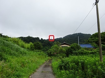
Arrived at 10:31, about an hour from the bus stop. [Time as written in the source.]
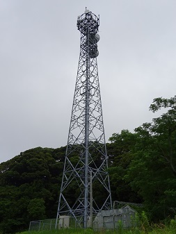
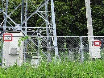
There was an HBC sign. Bingo!
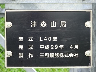
The tower also had a nameplate, revealing the station name.
Close-ups
The top of the tower. The large dish pointing right is the route across Tokyo Bay to Koto Ward.
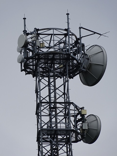
Towards Gotenyama. Previously I called it Takatoriyama, but I have now learned its official station name; more below.
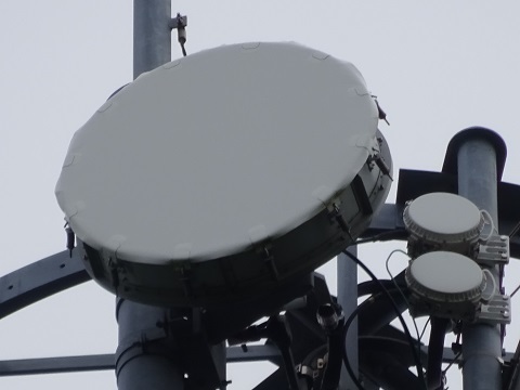
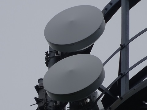
Towards central Tokyo:
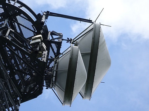
Equipment
For any fellow equipment enthusiasts. The main equipment.
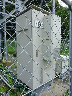
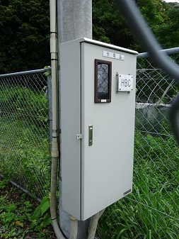
The electrical service panel.
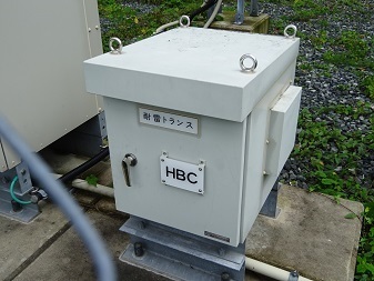
The lightning-protection transformer.
The feeders.
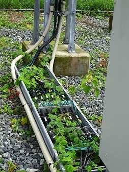
Are there labels?
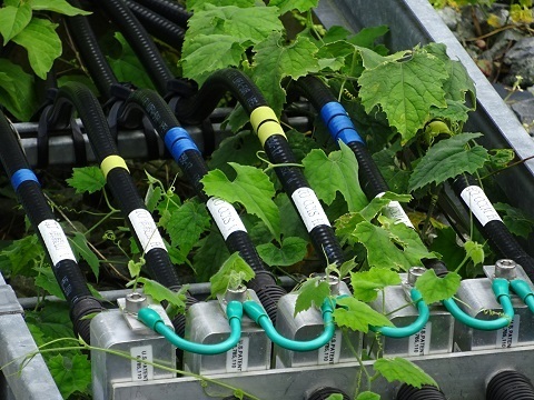
Yes. Reading them after getting home, starting from the right/east side of the photograph:
| Label | Inferred meaning | Main/sub | Polarization |
|---|---|---|---|
| TO CC1M H | AT TOKYO Central Center | Main | Horizontal |
| TO CC1M V | AT TOKYO Central Center | Main | Vertical |
| TO CC1S H | AT TOKYO Central Center | Sub | Horizontal |
| TO CC1S V | AT TOKYO Central Center | Sub | Vertical |
| TO 御殿山 H | Gotenyama | Horizontal | |
| TO 御殿山 V | Gotenyama | Vertical |
CC1: AT TOKYO Central Center. ‘Visiting AT TOKYO, one of the world's largest data centres’: https://cloud.watch.impress.co.jp/docs/special/757800.html Gotenyama: I called it Takatoriyama in the earlier report, but have now identified the station name. Location: https://www.google.com/maps/@35.081958,139.9447577,45m/data=!3m1!1e3
Cosmo Classic Club in the distance
I could see the other operators' towers there, which I visited last time. However, Gotenyama, the counterpart of this station, is not visible. Nor is Kamogawa-no-Inu, on HBC's other route. It lies farther to the left of this photograph.
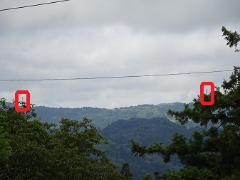
The right-hand tower. I infer that GT Technologies Japan and NuVo Networks share it.
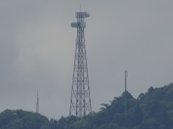
The left-hand tower. Already identified as JOSADA TELECOM's. You can see the HF antenna mounted on it.
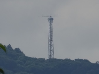
The Koto Ward end
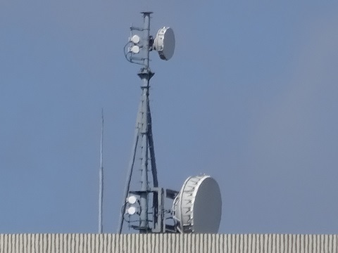
Looking for a dish that resembles Tsumoriyama's, this one on the TEPCO Toyosu Building is probably it:
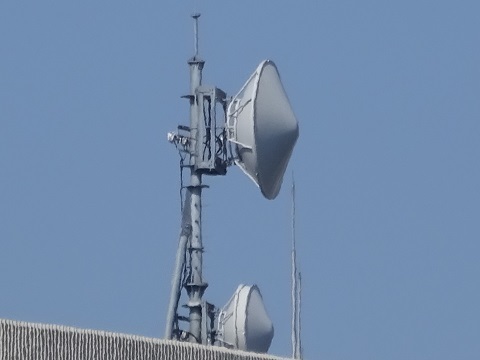
Could this be the counterpart of Kamogawa-no-Inu on the other route?
Summary
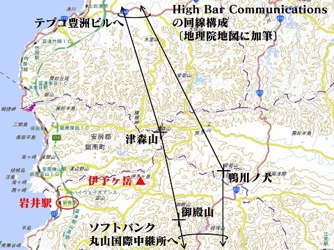
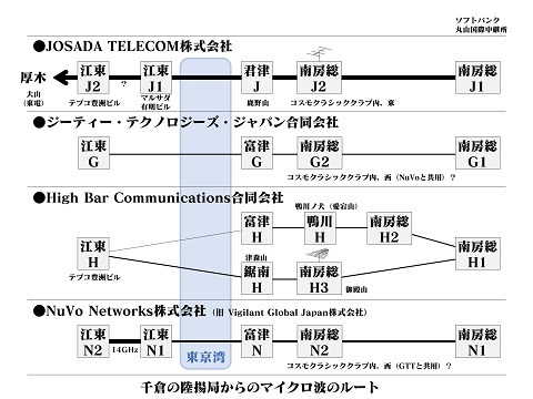
Some of Futtsu G, Futtsu H and Futtsu N are probably at Mother Farm. [Added July 11.] On the roof of WAKUWAKU: https://www.google.com/maps/@35.2464471,139.9359607,44m/data=!3m1!1e3 Street View: https://www.google.com/maps/@35.2470328,139.9351265,3a,15y,132.04h,101.8t/data=!3m7!1e1!3m5!1sTY_fneKyzRRZ8Zi0aKxKWg!2e0!6shttps:%2F%2Fstreetviewpixels-pa.googleapis.com%2Fv1%2Fthumbnail%3Fpanoid%3DTY_fneKyzRRZ8Zi0aKxKWg%26cb_client%3Dmaps_sv.tactile.gps%26w%3D203%26h%3D100%26yaw%3D151.52536%26pitch%3D0%26thumbfov%3D100!7i16384!8i8192 South of the road, near the entrance: https://www.google.com/maps/@35.2468755,139.93568,44m/data=!3m1!1e3 Street View: https://www.google.com/maps/@35.2470841,139.9360851,3a,15y,185.52h,107.28t/data=!3m6!1e1!3m4!1sjzd33Aq_OWQ-5CjghdDMRA!2e0!7i16384!8i8192 South of the road, near the hilltop gate: https://www.google.com/maps/@35.2459607,139.9335469,44m/data=!3m1!1e3 Street View: https://www.google.com/maps/@35.2460366,139.9333135,3a,15y,122.43h,133.92t/data=!3m7!1e1!3m5!1sDO1XXqP4p9BTEXAndmhrTA!2e0!6shttps:%2F%2Fstreetviewpixels-pa.googleapis.com%2Fv1%2Fthumbnail%3Fpanoid%3DDO1XXqP4p9BTEXAndmhrTA%26cb_client%3Dmaps_sv.tactile.gps%26w%3D203%26h%3D100%26yaw%3D171.94916%26pitch%3D0%26thumbfov%3D100!7i16384!8i8192 North of the road: https://www.google.com/maps/@35.2478884,139.9365016,89m/data=!3m1!1e3 Street View: https://www.google.com/maps/@35.2470666,139.9356833,3a,15y,42.64h,95.12t/data=!3m6!1e1!3m4!1sRvklKlLx4pAtBPrwfSqq5A!2e0!7i16384!8i8192
Earlier posts
‘JA/CB-002’: JOSADA TELECOM on Mount Kanozan. https://jj1wtl.seesaa.net/article/499180322.html (English translation) ‘Microwave routes — Toyosu and Shinonome’. https://jj1wtl.seesaa.net/article/499593521.html (English translation) ‘JA/CB-004’: two stations inside Cosmo Classic Club; HBC Kamogawa-no-Inu; HBC Gotenyama, or Takatoriyama. https://jj1wtl.seesaa.net/article/499505940.html (English translation) ‘JS2RA / JS2RB’. https://jj1wtl.seesaa.net/article/499204144.html (English translation)