JS2SB, continued
Original: Ryota / JJ1WTL — 505597775 · Original Japanese HTML
Published: 2024-11-09T19:10:00+09:00
English translation of the archived article text. The author’s first-person observations, uncertainty and later additions are preserved; this is not the research summary. Image contents are preserved as images, not silently incorporated into the translated prose.
Found it.
Previously
JS2SB
https://www.tele.soumu.go.jp/musen/SearchServlet?pageID=4&IT=A&DFCD=0004467072&DD=1&styleNumber=21
The third search for this station.
A new experimental HF digital fixed station, licensed October 22. The sole clue: Futtsu City.
So far, I had searched from:
-
The first candidate, Mother Farm;
-
Nokogiriyama at the city's southern end;
but found nothing in either long-distance survey.
A possible coastal location, like NuVo at Minamihara, was also possible, so I looked for somewhere with a view over the northern part of the city:
-
Hitomi Shrine, coincidentally featured in Radio Life magazine; or
-
Tokyo Bay Kannon.
Let's choose Tokyo Bay Kannon, which offers height.
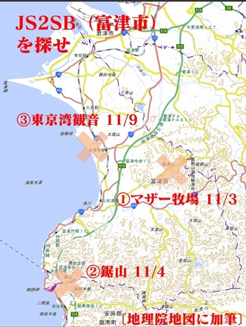
If this fails, I will have to go farther inland, toward Mount Takago and Mount Atago.
Earlier article with station specifications and comparisons: ‘JS2SB’.
https://jj1wtl.seesaa.net/article/505386673.html (English translation)
First, reviewing Mother Farm
It was not a wasted trip.
I had been unable to decide whether this pole belonged to NuVo Networks or GT Technologies. Now I have identified it as NuVo's.
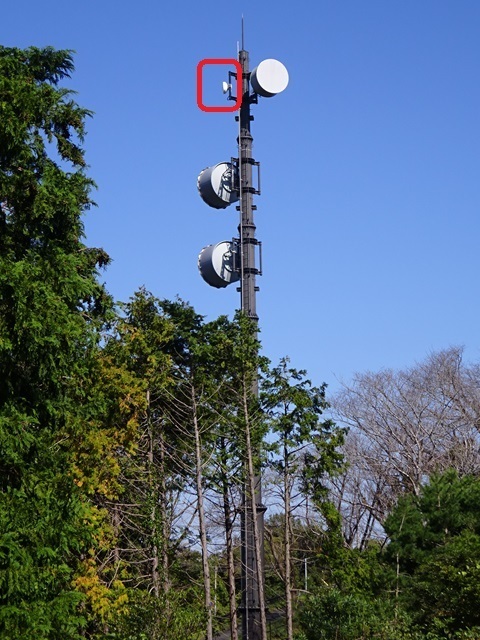
There, at the lower right of the electricity box.
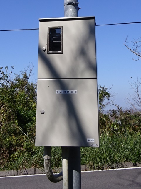
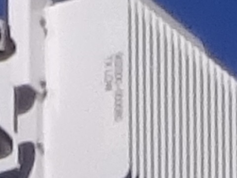
And the dish outlined in red in the photo above had been added.
When I visited in July 2023 (https://jj1wtl.seesaa.net/article/500063022.html (English translation)), it was not there.
Remember this shape.
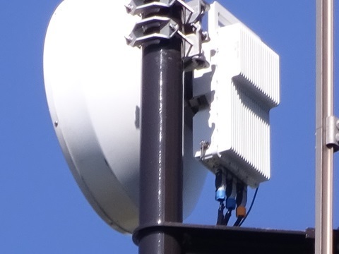
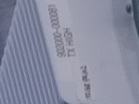
The lower printed line reads TX LOW.
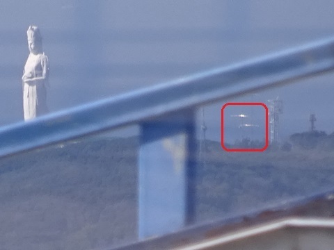
…Furthermore, when I examined a zoomed photograph taken from the Ferris wheel, today's target was in it. I hadn't noticed.
To the site
Saturday, November 9.
Tamachi 4:52 → Tokyo 5:01 / 5:21 → Kisarazu 6:42 / 6:47 → Sanukimachi 7:20.
Tamachi 4:52. Missed photographing the Shinkansen maintenance vehicle; it is getting darker now.
Tokyo 5:21. Arriving from the opposite direction.
Kisarazu 6:47.
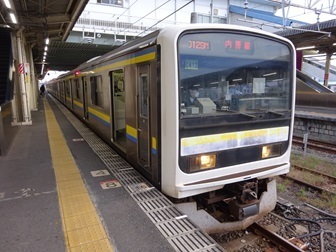
This time I take a sea-side compartment seat and search the ridgeline.
?!
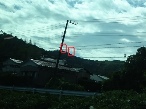
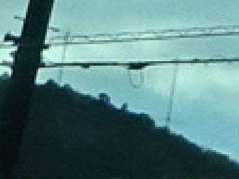
Then, briefly, two towers. Photograph taken on the return trip.
After leaving Onuki, well before the tunnel.
Could this be it? If so, can I get there?
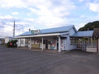
Sanukimachi 7:20. Here I am again. ¥1,694.
Last time: the tower cluster on Mount Kanozan, including JOSADA TELECOM, then SOTA operation.
For now, continue as planned to Tokyo Bay Kannon and search for the towers seen from the train.
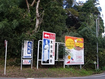
North along National Route 465, then left/west at this sign.
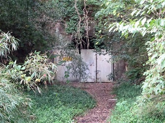
Is this the much-discussed abandoned tunnel?
Continuing ahead, a brand-new service pole draws my eye to the right…
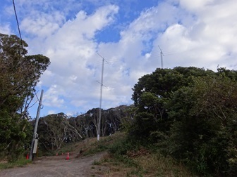
So much for wondering whether access was possible. Access is extremely easy:
https://www.google.com/maps/@35.2632551,139.8652375,416m/data=!3m1!1e3
Yahoo! Maps shows the cleared site [added November 10]:
https://map.yahoo.co.jp/address?ac=JP&lat=35.26342&lon=139.86535&zoom=17&maptype=satellite
Arrived at 7:41, just over twenty minutes on foot from Sanukimachi Station.
Overall view
Enjoy.
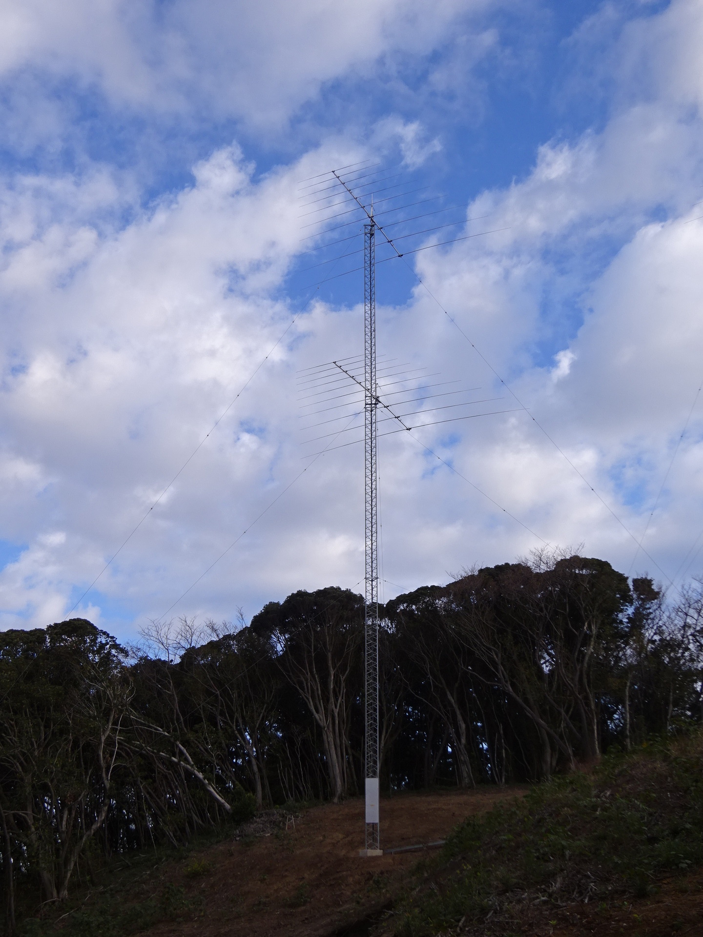
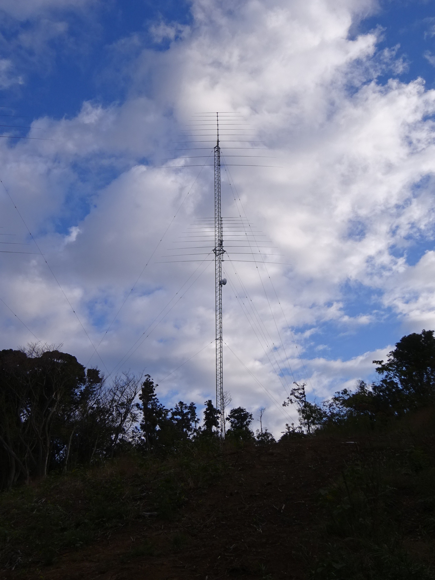
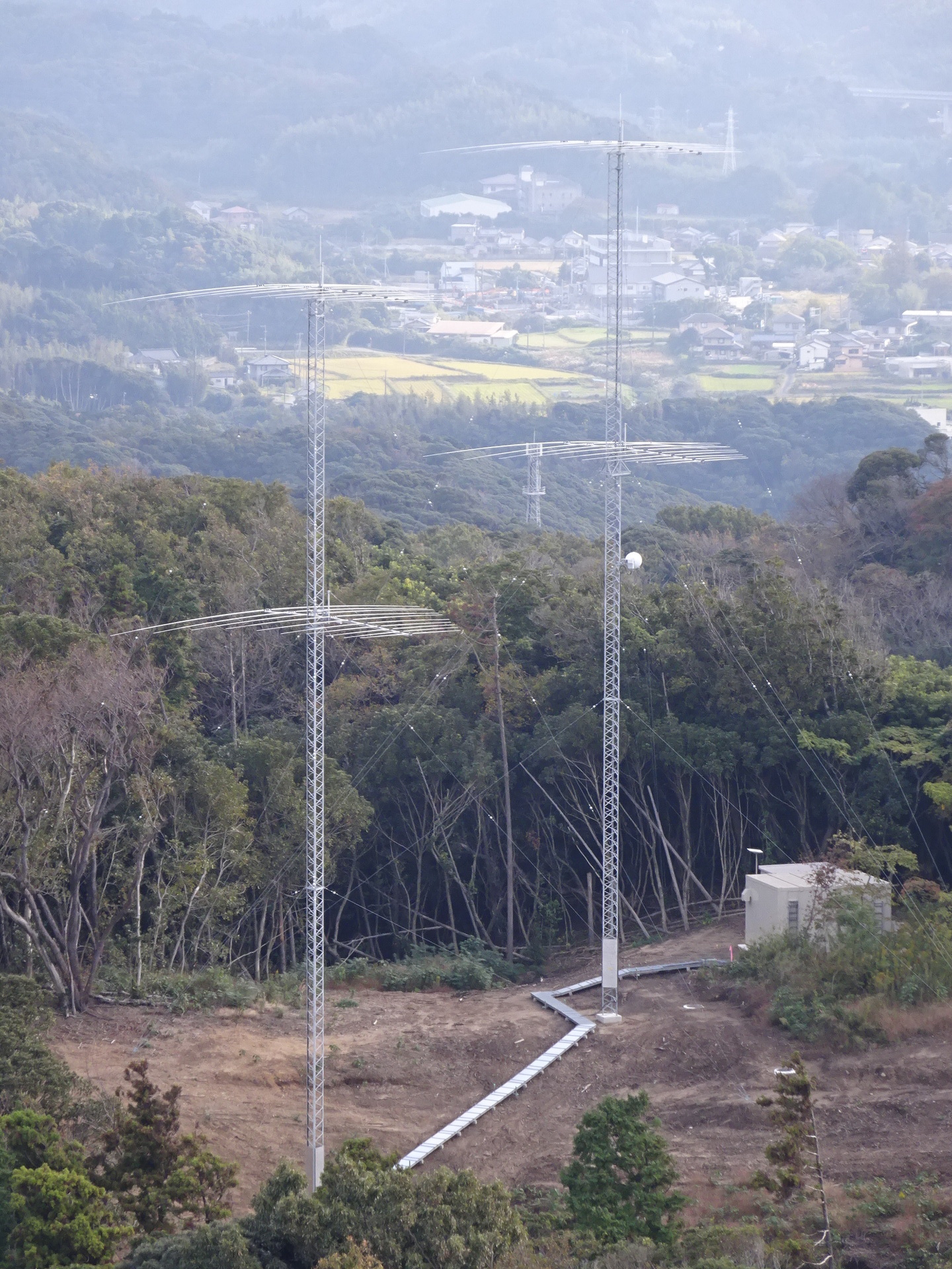
Twin towers.
There is a dish midway up the right-hand tower; more below.
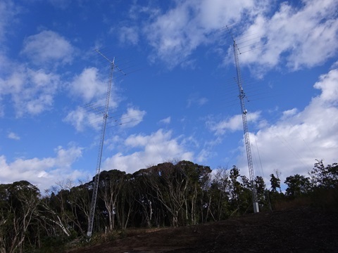
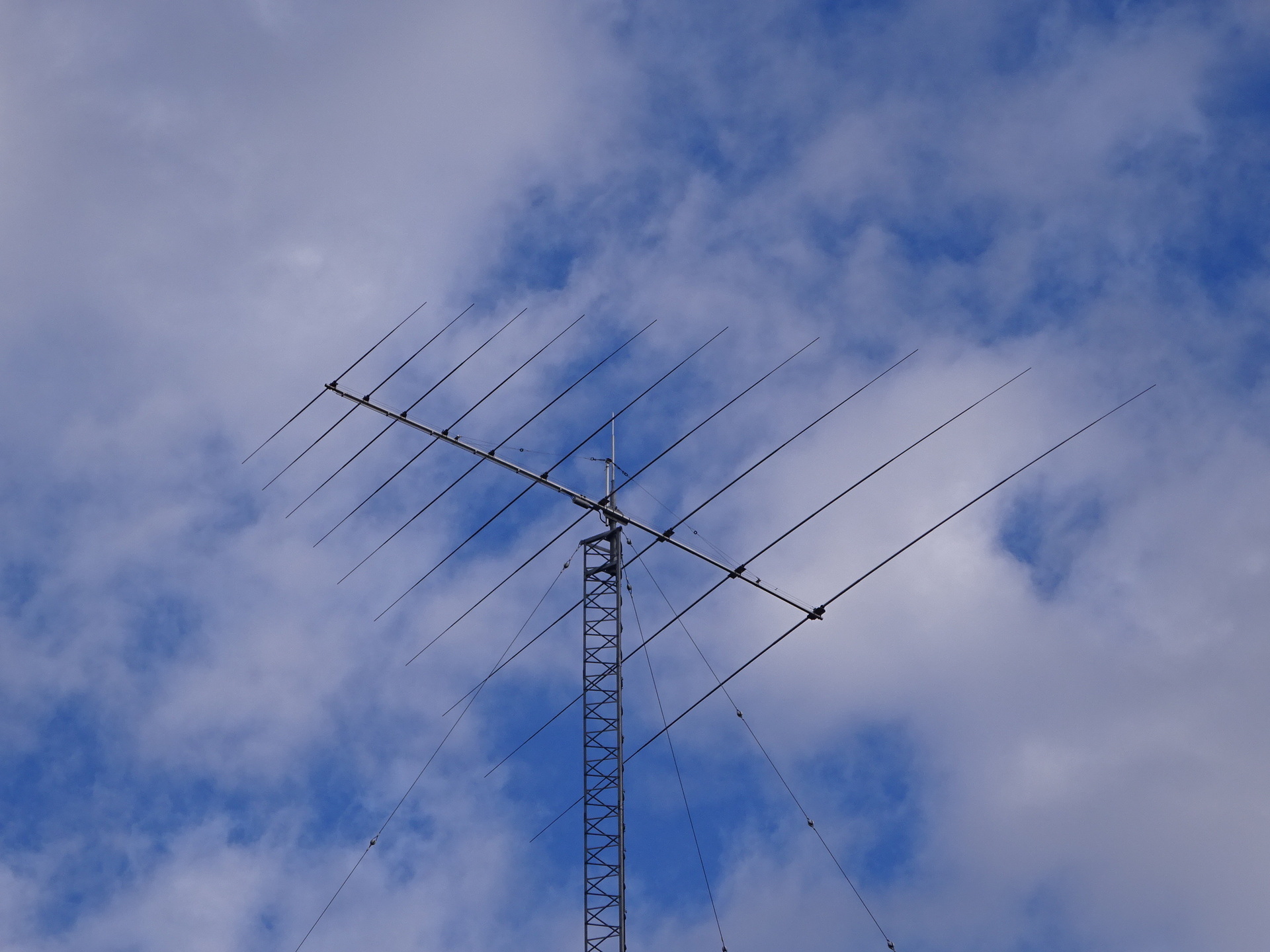
Left/west as viewed. Are the upper and lower antennas identical? Ten elements. Create-made tower. Click to enlarge, 1.92 MB.
Right/east. Click to enlarge, 1.85 MB.
A close-up of the upper antenna on the left/west tower as an example. Click to enlarge, 1.61 MB.
With Kannon in the lower-left corner.
Mounting and guys
For those interested.
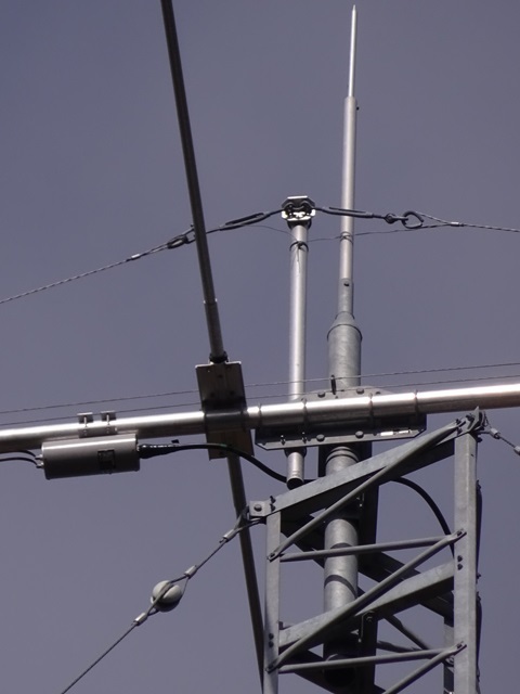
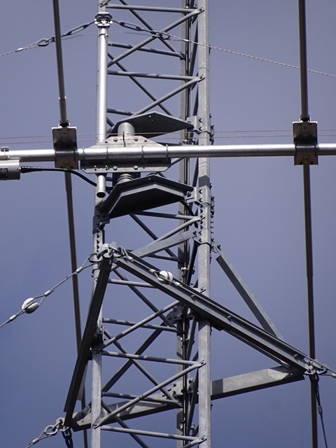
On the eastern tower, to the right when looking upward from the front.
Upper.
Lower.
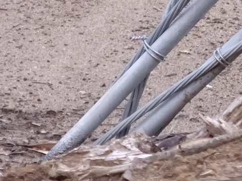
One of the three guy directions.
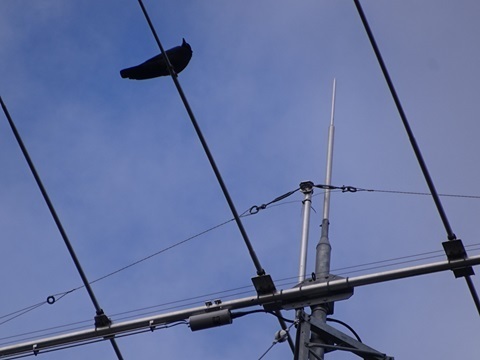
Kyoe-chan, don't get into the habit of perching there. That's 8 kW.
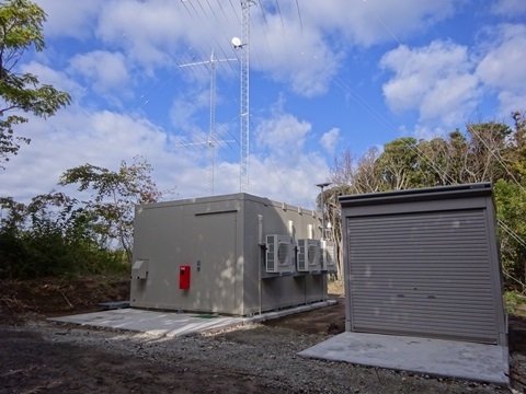
Station buildings
Two shots.
I could hear fans, so something was running.
Starlink behind the left building. Probably for control and monitoring; carrying the actual traffic to Tokyo over Starlink would undo the latency reduction achieved up to this point.
From downhill.
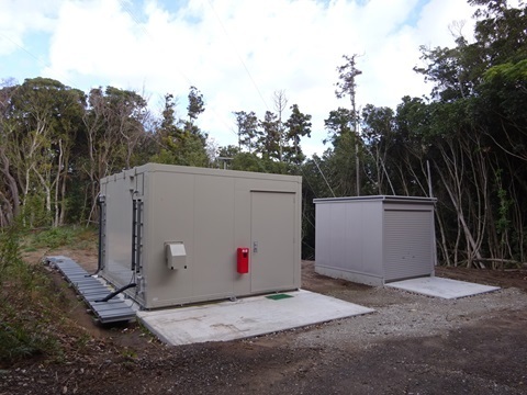
From above.
Counterpart directions
From the road leading to Tokyo Bay Kannon.
They point west-southwest.
Splayed slightly apart, perhaps?
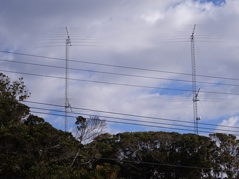
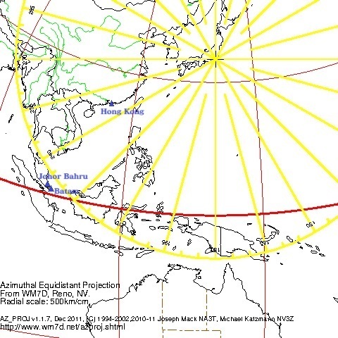
The licensed correspondents are:
Receiving equipment belonging to the licensee near Hong Kong, China; Batam Island, Indonesia; and Johor, Malaysia.
Those are the entries.
Of these:
-
Batam Island: south of Singapore.
-
Johor: north of Singapore.
Those two are close together on either side of Singapore, so presumably they share an antenna.
Geographical diversity, perhaps?
Thus I inferred:
-
Left: VS6 [Hong Kong] beam.
-
Right: 9V [Singapore] beam.
That was my interpretation.
Generating a great-circle map (https://www.wm7d.net/az_proj/az_html/azproj_form_short.shtml) gives the following:
Dish
Presumably the counterpart to the Mother Farm antenna discussed above.
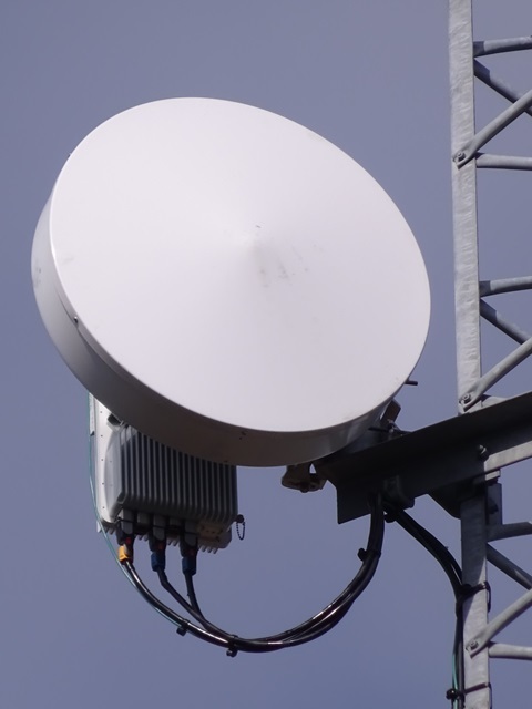
The shape is the same.
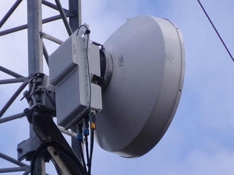
This one is marked TX HIGH, which fits.
From the crown observation deck of Tokyo Bay Kannon
Since I am here, to give thanks for divine protection—really, to pin down the QTH in detail.
The antenna-site entrance is here; turn right here.
Kannon is at the rear left of the photo. The brick-style building is Ikoi-no-Sato Olive.
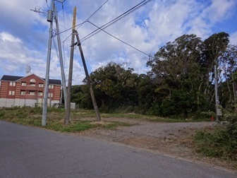
Enter for ¥500 admission.
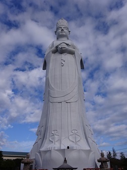
It is visible from Kannon's feet too. You could have told me…
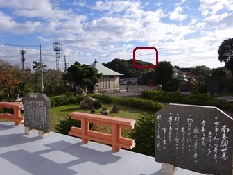
To the top.
I intended to search from up here… but it was right at my feet, orz.
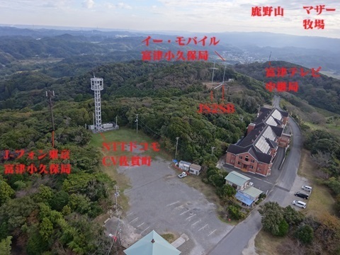
Enlarged; click for 2.91 MB.
Mother Farm is visible.
The microwave counterpart is NuVo's pole.
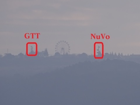
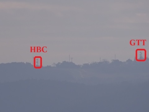
Swinging slightly left/east.
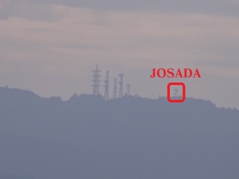
Getting carried away: the radio-tower cluster still farther east on Mount Kanozan.
Analysis article: ‘JA/CB-002’.
https://jj1wtl.seesaa.net/article/499180322.html (English translation)
What was this place?
Yokkiren (https://yamaiga.com/) would ask a local elder.
Following that example, I spoke to the man at Tokyo Bay Kannon's reception desk.
Success:
‘They did quite substantial construction work.’
‘There used to be an NHK analogue television relay station here.’
[Supplement, November 11: apparently Chiba Television.]
That was what he said.
Around here:
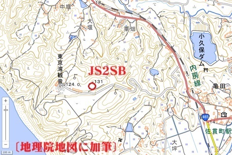
I'll bet 3,000 points the signal dips whenever an aircraft arriving at or departing Haneda passes overhead. If it is only used for transmission, perhaps it will be all right.
Triumphant return
Early, but successful: withdrawing.
Sanukimachi 10:30.
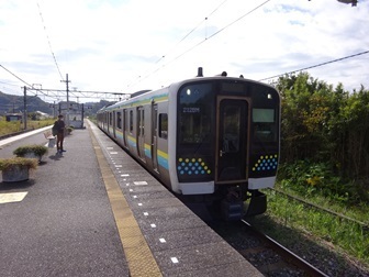
Cross-platform change at Kimitsu, 10:50.
Shimbashi, 12:33.
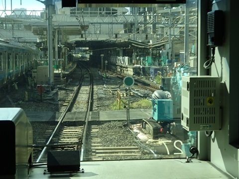
Haneda new-line construction report.
First they will move the clockwise Yamanote Line, which I am riding, to the new track in the centre of the photograph.
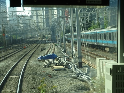
Speed restriction.
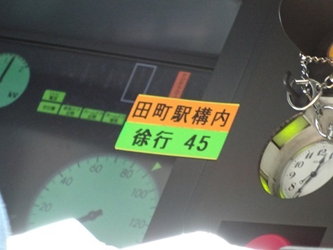
The northern end of Tamachi Station's platform will have to be shifted sideways.
For those who read to the end
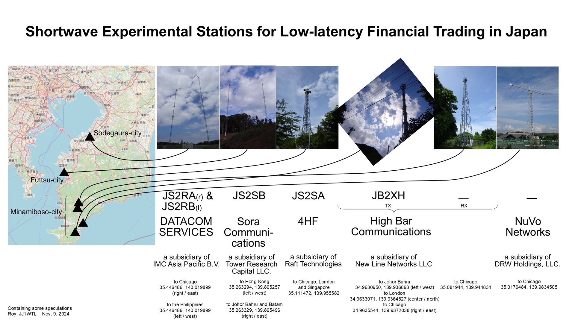
Overview diagram; click to enlarge, 810 KB.
To state the obvious at this late stage, I still need to establish whether this site truly belongs to Sora Communications.
Circumstantially it fits: within Futtsu City, beams toward Southeast Asia.
Earlier posts
‘JS2RA / JS2RB’
https://jj1wtl.seesaa.net/article/499204144.html (English translation)
‘JA/CB-004’ (4HF's JS2SA and HBC's JB2XH, later classified as a receive station)
https://jj1wtl.seesaa.net/article/499505940.html (English translation)
‘JS2SA / JB2XH’
https://jj1wtl.seesaa.net/article/500304565.html (English translation)
‘The new JB2XH’ (transmit station)
https://jj1wtl.seesaa.net/article/504743515.html (English translation)
‘The Minamihara log-periodic’ (NuVo Networks)
https://jj1wtl.seesaa.net/article/501355072.html (English translation)
『JS2SB』
https://jj1wtl.seesaa.net/article/505386673.html (English translation)
Comments
Translated from the comments in the archived original HTML. Author names and timestamps are retained as displayed; these are separate from the article.
ISO — 2024-11-11 12:54
Thank you for always sharing these excellent investigative reports.
In Google Earth Pro, the Windows desktop version, go to View → Historical Imagery and look at the image acquired on March 3, 2024: you can see the vegetation clearance. In the imagery up to March 23, 2014, you can also see some kind of steel pole or tower. Older GSI maps also mark a radio tower at this location.
Television transmitter listing
It says this was the CTC, Chiba Television, analogue Futtsu relay station, a standalone station. Although the local elder seems to have mistaken the broadcaster's name, the part about there having been a television relay station appears to be correct.