JS2SB, continued again
Original: Ryota / JJ1WTL — 511302814 · Original Japanese HTML
Published: 2025-03-08T01:09:00+09:00
English translation of the archived article text. The author’s first-person observations, uncertainty and later additions are preserved; this is not the research summary. Image contents are preserved as images, not silently incorporated into the translated prose.
Hello to everyone in the Log-peri Researchers Association of Japan (LRAJ). Now, about the log-periodics beside Tokyo Bay Kannon (click the photo to enlarge, 2.5 MB): until now I had not been able to confirm whether they really were Sora Communications' JS2SB, but now I have.
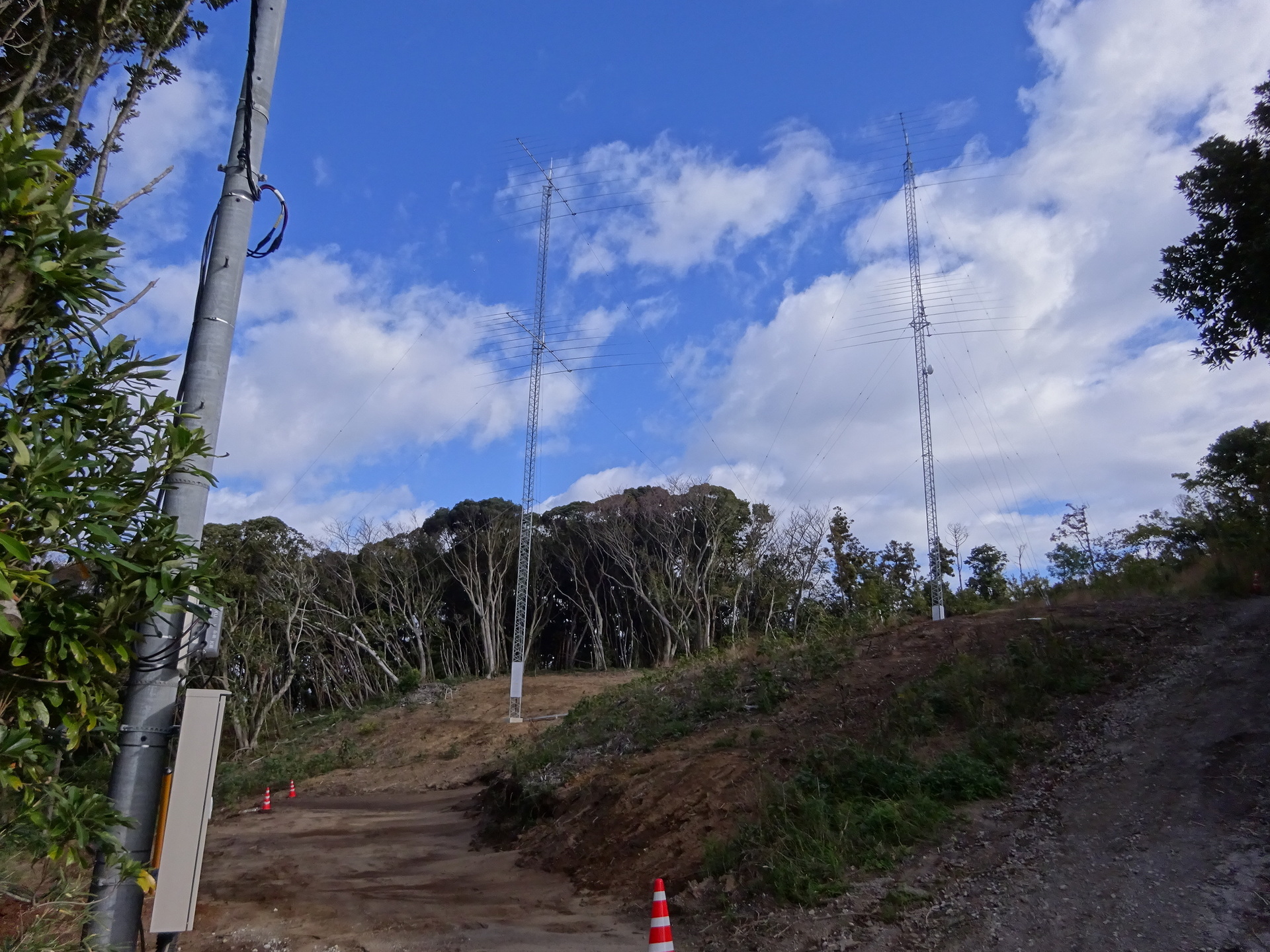
The circumstantial evidence pointed here ↑: ‘within Futtsu City’, and ‘aimed at VS6 and 9V’ [Hong Kong and Singapore].
But I did not have confirmation.
Approaching it through the landowner
The usual method.
…But in this particular case it came to nothing.
First, identify the parcel number
I stumbled immediately. Orz.
It is not in the parcel-number search service:
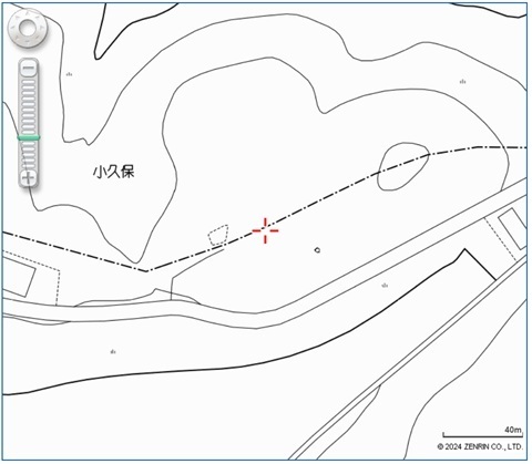
So:
Starting from somewhere whose parcel number is available, I look up land registrations and assemble the cadastral maps like a patchwork.
You can do this from home before 8 p.m.
…But it has cost about ¥3,000 in total (annotations on a GSI map):
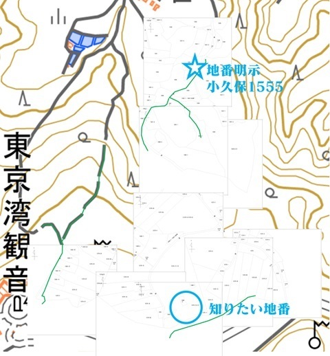
Eventually I narrowed it down to ‘probably 1579-2, Higashisekiyama, Kokubo, Futtsu City’ (click to enlarge, 123 KB):
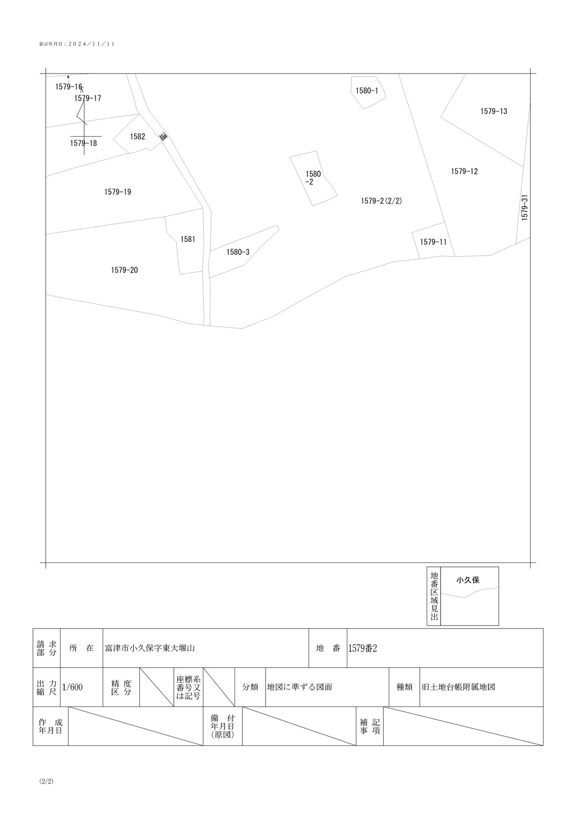
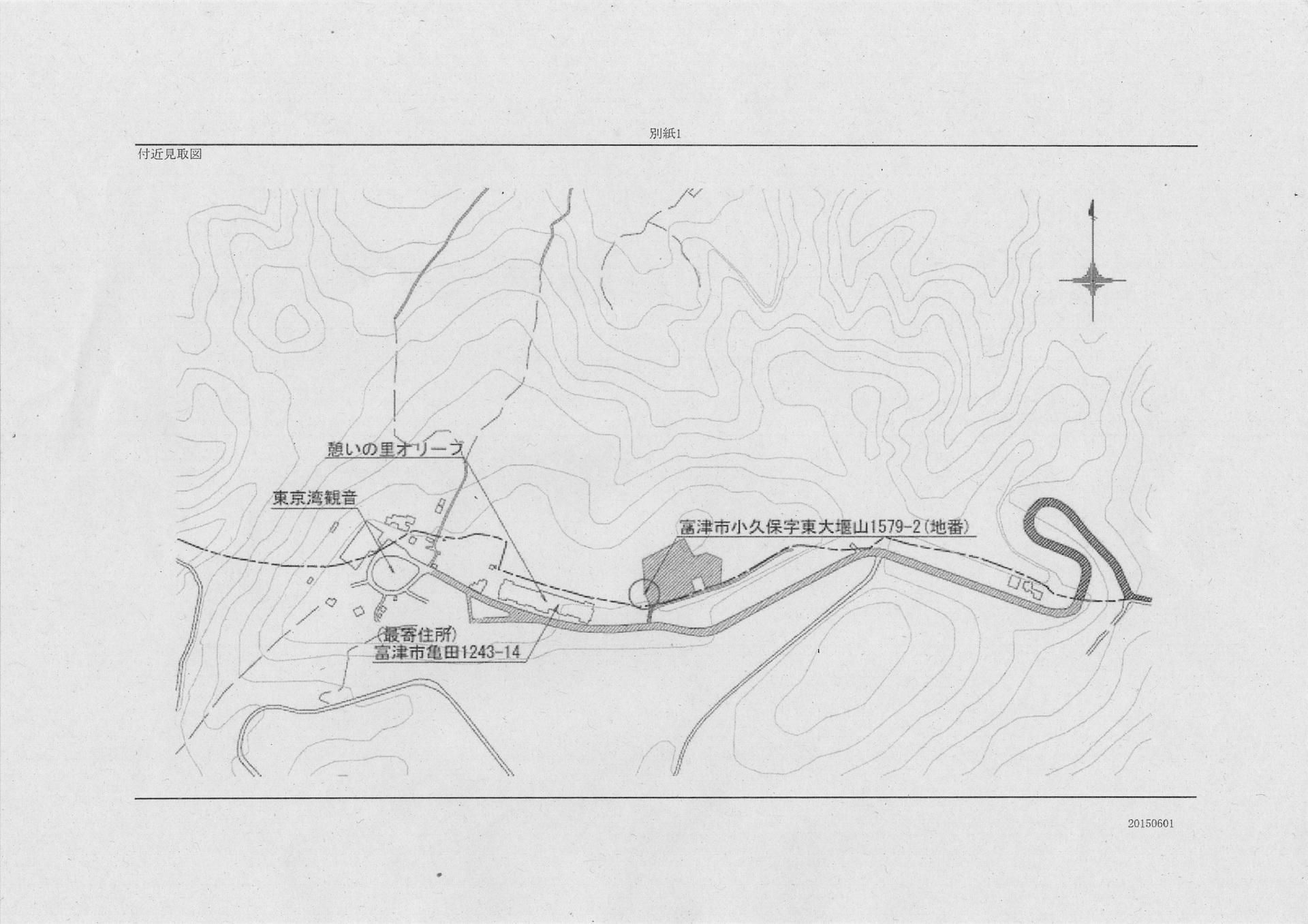
Besides the parcel numbers shown here, part of ‘1243-15, Otsuboyama, Kameda’ is also included in the site.
The land was registered in an individual's name.
It was not the antenna owner's name.
…Plan failed.
Presumably it is leased land.
Approaching it through the building application
My first attempt at this.
Of course, inspection requires taking time off and going on a weekday.
That is why the investigation had stalled for so long, but today—Friday, March 7—I went ahead.
Calling Futtsu City Hall
I asked which office I should visit:
-
Futtsu City Hall.
-
Chiba Prefecture's Kimitsu Civil Engineering Office.
…It turned out to be the latter.
So I only needed to go as far as Kisarazu Station, which has frequent trains.
Calling the Kimitsu Civil Engineering Office
They ask you to check whether the records exist before coming.
‘I know the address: 1579-2 Kokubo, Futtsu City.’
Apparently there are buildings and structures at that address.
I asked something like, ‘I think the owner is probably Sora Communications GK, written in Roman letters,’ received an acknowledgement, and the identification was complete at that point.
Still, it would be nice to learn things such as the tower height, so I decided to visit.
A round trip to Kisarazu
Before that, I stopped at Komagome and bought Supplement 47 to the Examination Standards Related to the Radio Act.
Komagome 10:51 → Tokyo 11:15 → Chiba 11:55 / 12:01 → Kisarazu 12:40. ¥1,342.
Komagome.
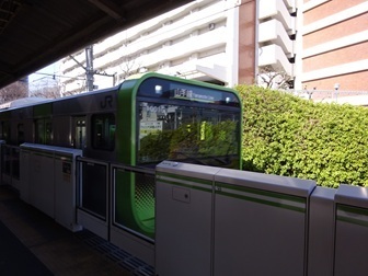
Tokyo.
Changing at Chiba.
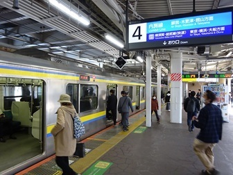
Arriving at Kisarazu Station, west exit.
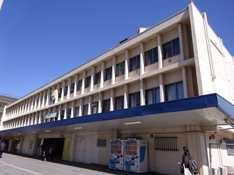
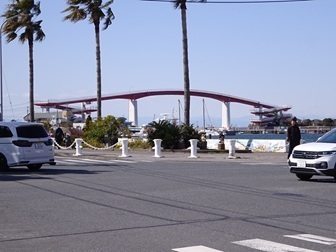
An intriguing structure. Turn left here.
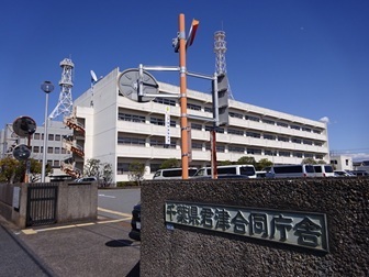
Arriving at the joint government office building.
The towers:
-
Rear left: TEPCO's. Its microwave counterpart is JERA's Sodegaura Thermal Power Station; the antennas are not visible in the photograph.
-
Front right: Chiba Prefecture's, currently unused following its ‘move away from microwave’ declaration.
《Mission successfully completed.》
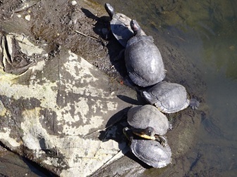
Turtles sunning themselves in the waterway outside the civic hall.
Back at Kisarazu Station at 14:10.
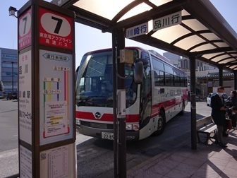
Let's take the bus back. There are plenty here. I chose the 14:30 departure for Shinagawa (¥1,500).
Kisarazu 14:30 → Shinagawa 15:32 / 19:19 → Tamachi.
I spent time wandering around inside Shinagawa Station and ended up late… (¥146).
[1] The station building's Building Plan Summary
Seven pages in all, like this.
They said I could obtain copies, so I did: seven sheets, ¥70 in total.
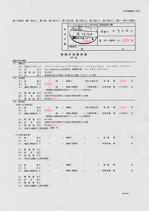
The remarks column says:
Plan to construct communications towers for experiments in the HF band.
Drawings were attached
Vicinity map
The parcel number I worked so hard to piece together was correct (click to enlarge, 1.0 MB):
Inside the site
Enjoy. Click to enlarge (1.2 MB):
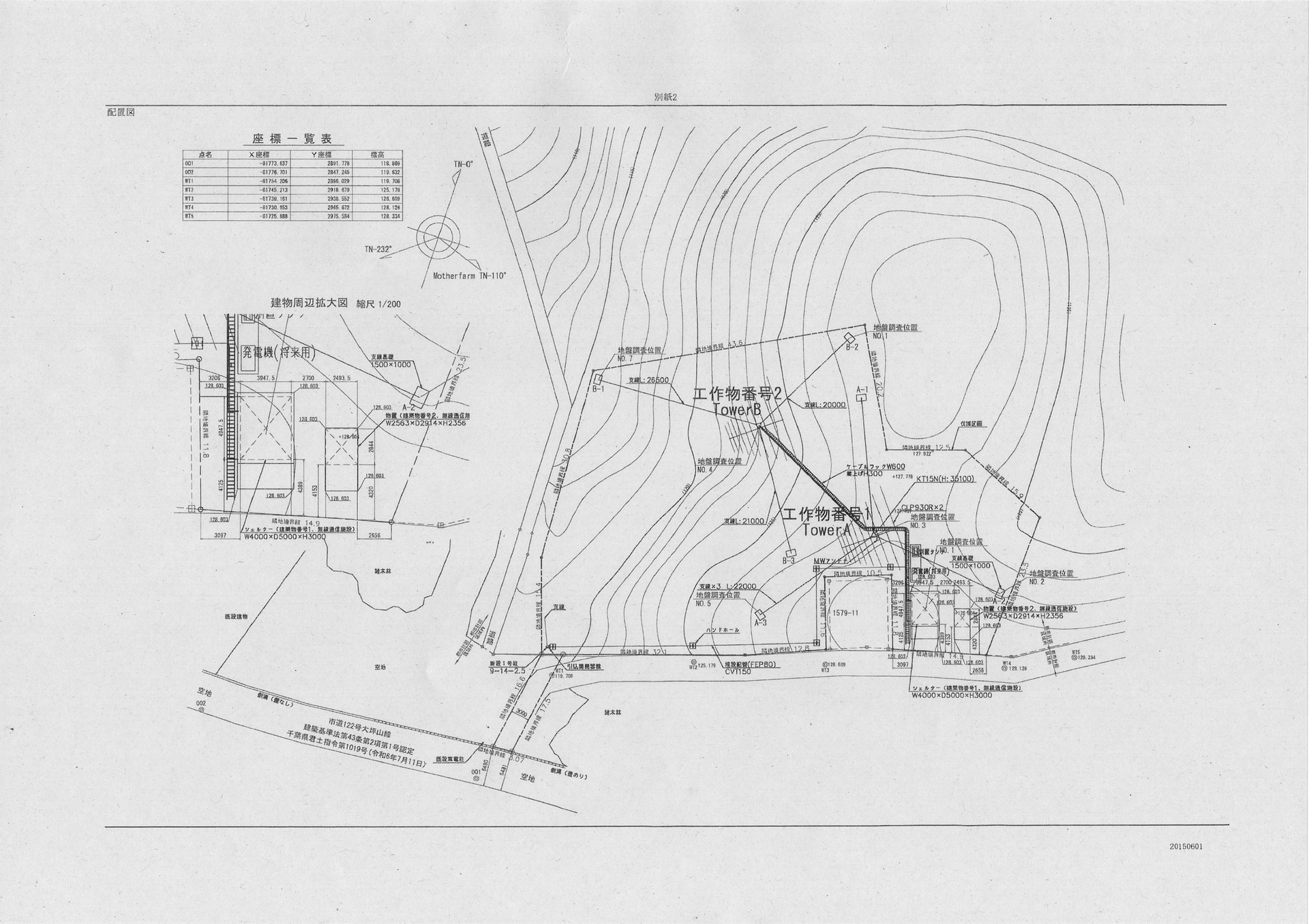
The square parcel ‘1579-11’ may be where Chiba Television's analogue relay station used to stand.
Bearing diagram
Oh? A bearing diagram is included:
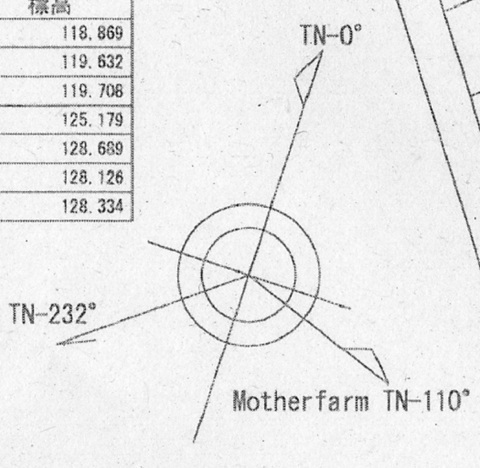
Motherfarm
Mother Farm was the place I had identified as the microwave counterpart.
Bingo.
The tower on the right (east) of the drawing is annotated ‘MW antenna’.
(TN: True North.)
232°
That is the direction of 9V [Singapore].
Radio Station Information Search lists VS6 (Hong Kong) as the other counterpart. If that were the destination, the bearing should be farther north, around 247°.
The two log-periodics in the diagram also have the same beam direction.
I had thought the left (west) one was for VS6 [Hong Kong] and the right (east) one for 9V [Singapore].
[2] The towers' Certificate of Entries in the Building Register (Structures)
For ‘structures’, apparently there is no equivalent of the plan summary described above. All they can supply is the Certificate of Entries in the Building Register (Structures).
One A4 sheet, ¥400.
An extract follows.
Even so, it gives us the tower height: 35.1 m.
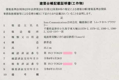
That falls short of Sodegaura's 59 m, but Tokyo Bay Kannon has the advantage in site elevation:
| Station | Elevation | Tower height |
|---|---|---|
| JS2RA・JS2RB | 44 m | 59 m |
| JS2SB | 128 m | 35 m |
Chronology
2024-04-26: Approval certificate issued for the structures (= towers). 2024-07-18: Building Plan Summary received. 2024-07-26: Building Plan Summary confirmed. 2024-10-22: Full radio licence issued. 2024-10-25: JS2SB appears in the Radio Station Information Search. 2024-11-03: Futtsu search #1, Mother Farm: no success; later found to have been captured in the photographs. 2024-11-04: Futtsu search #2, Nokogiriyama: no success; enjoyed SOTA. 2024-11-05: Inspection completion certificate issued for the structures (= towers). 2024-11-10: Futtsu search #3: found it immediately beside Tokyo Bay Kannon!
Current satellite imagery
Yahoo! Maps
Tree clearance and grading are in progress:
https://map.yahoo.co.jp/?lat=35.26344&lon=139.86543&zoom=19&maptype=satellite
Google Maps
Before tree clearance:
https://www.google.com/maps/@35.26344,139.86543,52m/data=!3m1!1e3
Earlier posts
About this site
‘JS2SB’ (licence information)
https://jj1wtl.seesaa.net/article/505386673.html (English translation)
‘JS2SB, continued’ (site photographs)
https://jj1wtl.seesaa.net/article/505597775.html (English translation)
About other sites
‘JS2RA / JS2RB’
https://jj1wtl.seesaa.net/article/499204144.html (English translation)
‘JA/CB-004’ (4HF's JS2SA and HBC's JB2XH, later understood to be a receive station)
https://jj1wtl.seesaa.net/article/499505940.html (English translation)
‘JS2SA / JB2XH’
https://jj1wtl.seesaa.net/article/500304565.html (English translation)
‘The Minamihara log-periodic’ (NuVo Networks)
https://jj1wtl.seesaa.net/article/501355072.html (English translation)
‘The new JB2XH’ (transmit station)
https://jj1wtl.seesaa.net/article/504743515.html (English translation)
‘JS2RA / JS2RB, continued’ (additional Philippines-bound Yagi)
https://jj1wtl.seesaa.net/article/505776879.html (English translation)
‘The log-periodic at Cosmo Classic Club’ (probably GTT)
https://jj1wtl.seesaa.net/article/508688232.html (English translation)